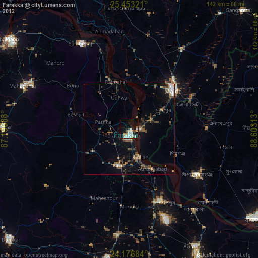
Farakka night lights from space
Night Light of Farakka (West Bengal) from space (India) Src. Average luminocity for 10x10km area is 42.2955% and for 50x50km: 18.7444%.
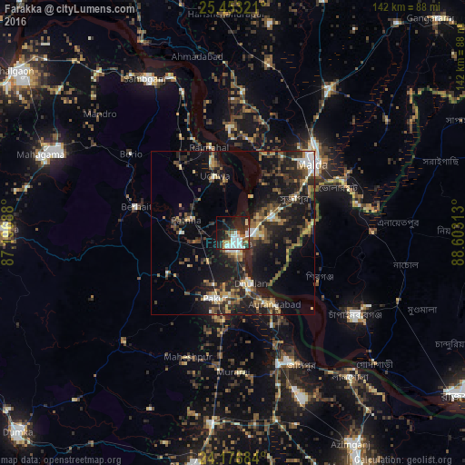
Analysis of Farakka night lights 2016
Square area 10x10 km:
 11.17%
90-99
10.98%80-89
1.33%70-79
2.08%60-69
5.49%50-59
4.36%40-49
3.41%30-39
5.68%20-29
14.77%10-19
27.65%0-9
13.07%Square area 50x50 km:
1.64%90-99
2.31%80-89
1.59%70-79
2.01%60-69
2.29%50-59
3.16%40-49
3.79%30-39
4.17%20-29
7.74%10-19
17.65%0-9
53.64%Clear (daylight) street map image can be seen on geolist.org.
Map coordinates:
25° 27' 11.6" North, 87° 11' 48.8" East
24° 49' 0" North, 87° 54' 0" East
24° 10' 36.6" North, 88° 36' 11.3" East
Some cities around Farakka sort by population:
• Ingrāj Bāzār
32.4 km =20.1 mi,  49°
49°
• Nawābganj, BD
45.4 km =28.2 mi,  123°
123°
• Sāhibganj
54.5 km =33.9 mi,  330°
330°
• Jangipur
42.5 km =26.4 mi,  155°
155°
• Dhuliān
16 km =9.9 mi, 160°
• Pakur
20.6 km =12.8 mi,  196°
196°
• Shibganj, BD
29.7 km =18.5 mi, 119°
• Rājmahal
27.2 km =16.9 mi,  345°
345°
1271954 (p: 21,834)
Sources (retrieved 2019-11-25):
» Earth at Night: Flat Maps 2012, 2016