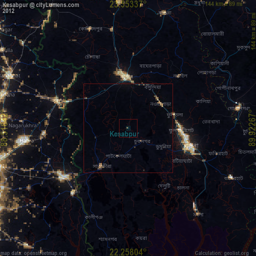
Kesabpur night lights from space
Night Light of Kesabpur (Khulna) from space (Bangladesh) Src. Average luminocity for 10x10km area is 0.7321% and for 50x50km: 1.7591%.
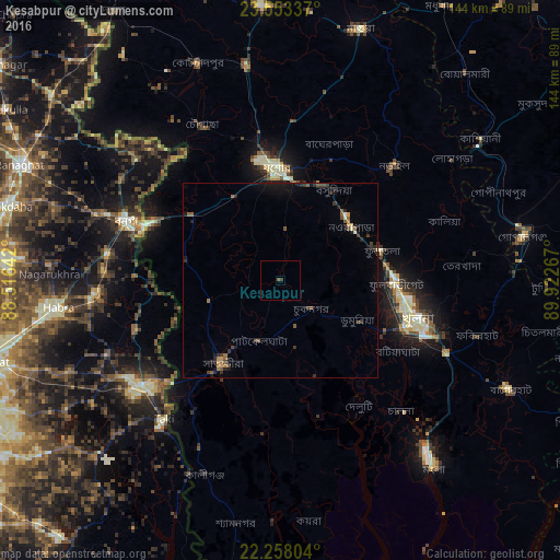
Analysis of Kesabpur night lights 2016
Square area 10x10 km:
 0%
0%90-99
0%80-89
0%70-79
0%60-69
0%50-59
0.79%40-49
0%30-39
0.6%20-29
0.2%10-19
0%0-9
98.41%Square area 50x50 km:
0.02%90-99
0.13%80-89
0.02%70-79
0.23%60-69
0.26%50-59
0.44%40-49
0.34%30-39
0.44%20-29
0.59%10-19
0.97%0-9
96.57%Clear (daylight) street map image can be seen on geolist.org.
Map coordinates:
23° 33' 12.1" North, 88° 30' 59.1" East
22° 54' 26.1" North, 89° 13' 10.3" East
22° 15' 28.9" North, 89° 55' 21.6" East
Some cities around Kesabpur sort by population:
• Khulna
37 km =23 mi,  107°
107°
• Jessore
29.2 km =18.1 mi,  358°
358°
• Sātkhira
26.8 km =16.7 mi,  214°
214°
• Bangaon, IN
42.7 km =26.5 mi,  291°
291°
• Narail
39.4 km =24.5 mi,  45°
45°
• Bhātpāra Abhaynagar
25.5 km =15.8 mi,  62°
62°
• Jhingergācha
26.3 km =16.3 mi,  329°
329°
• Phultala
36.7 km =22.8 mi,  125°
125°
1197895 (p: 30,926)
Sources (retrieved 2019-11-25):
» Earth at Night: Flat Maps 2012, 2016