Sātkhira night lights from space
Night Light of Sātkhira (Khulna) from space (Bangladesh) Src. Average luminocity for 10x10km area is 11.7083% and for 50x50km: 6.0668%.
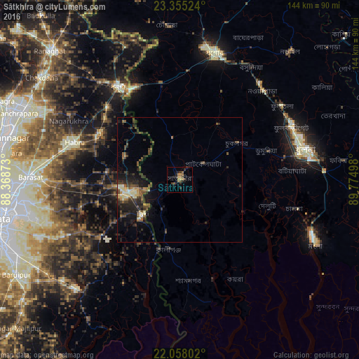
Analysis of Sātkhira night lights 2016
Square area 10x10 km:
 0%
0%90-99
0%80-89
0%70-79
3.17%60-69
4.37%50-59
1.19%40-49
1.98%30-39
3.97%20-29
4.76%10-19
4.37%0-9
76.19%Square area 50x50 km:
0.13%90-99
0.78%80-89
0.72%70-79
0.42%60-69
0.74%50-59
1.29%40-49
1.3%30-39
1.75%20-29
2.68%10-19
4.35%0-9
85.84%Clear (daylight) street map image can be seen on geolist.org.
Map coordinates:
23° 21' 18.9" North, 88° 22' 7.4" East
22° 42' 29.4" North, 89° 4' 18.7" East
22° 3' 28.9" North, 89° 46' 29.9" East
Some cities around Sātkhira sort by population:
• Bangaon, IN
44.9 km =27.9 mi,  326°
326°
• Badūria, IN
29.5 km =18.3 mi,  277°
277°
• Gobārdānga, IN
37.6 km =23.4 mi,  300°
300°
• Jhingergācha
44.9 km =27.9 mi,  2°
2°
• Tāki, IN
19.5 km =12.1 mi,  227°
227°
• Kesabpur
26.8 km =16.7 mi,  34°
34°
• Gurdaha, IN
32.2 km =20 mi, 275°
• Gopālpur, IN
34.4 km =21.4 mi,  253°
253°
1185111 (p: 128,918)
Sources (retrieved 2019-11-25):
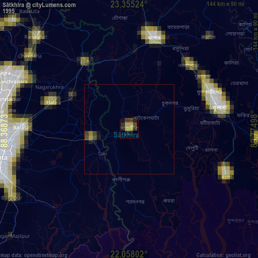
» NASA, Earths city lights 1995
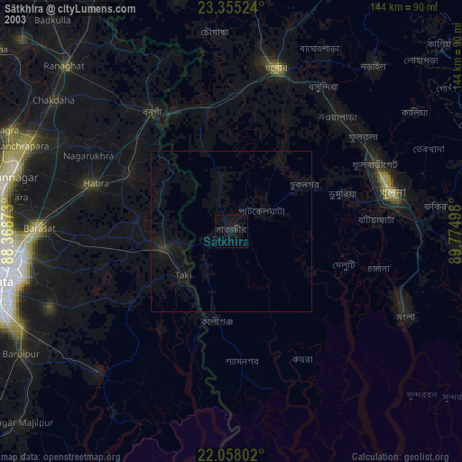
» NASA city lights 2003
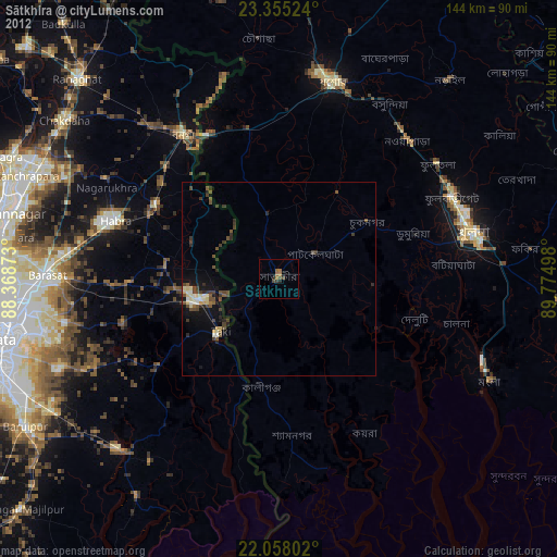
» Earth at Night: Flat Maps 2012, 2016