Phultala night lights from space
Night Light of Phultala (Khulna) from space (Bangladesh) Src. Average luminocity for 10x10km area is 1.4127% and for 50x50km: 5.9607%.
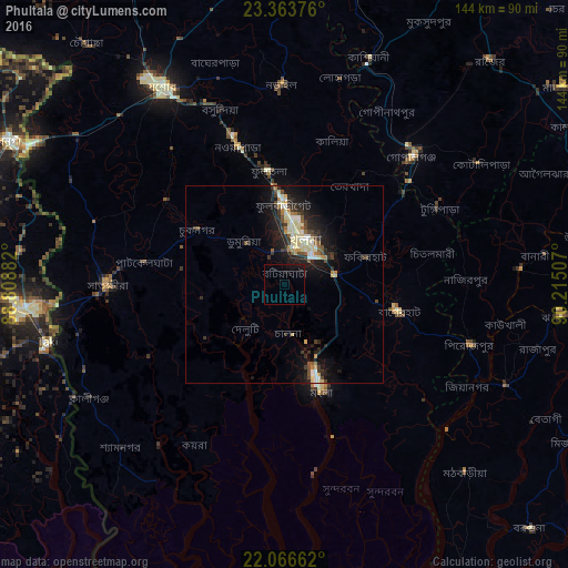

Analysis of Phultala night lights 2016
Square area 10x10 km:
 0%
0%90-99
0%80-89
0%70-79
0%60-69
0%50-59
0%40-49
0%30-39
0%20-29
0%10-19
4.37%0-9
95.63%Square area 50x50 km:
0.36%90-99
1.12%80-89
1.29%70-79
0.46%60-69
0.52%50-59
0.54%40-49
0.9%30-39
1.05%20-29
2.04%10-19
5.08%0-9
86.64%Clear (daylight) street map image can be seen on geolist.org.
Map coordinates:
23° 21' 49.5" North, 88° 48' 31.8" East
22° 43' 0.2" North, 89° 30' 43" East
22° 3' 59.8" North, 90° 12' 54.3" East
Some cities around Phultala sort by population:
• Khulna
11.7 km =7.3 mi,  27°
27°
• Bagerhat
29.4 km =18.3 mi,  103°
103°
• Sātkhira
45.1 km =28 mi,  268°
268°
• Tungipāra
45 km =28 mi,  63°
63°
• Bhātpāra Abhaynagar
34 km =21.1 mi,  347°
347°
• Kālia
38.3 km =23.8 mi,  18°
18°
• Morrelgonj
45.7 km =28.4 mi,  129°
129°
• Kesabpur
36.7 km =22.8 mi,  305°
305°
1191139 (p: 37,985)
Sources (retrieved 2019-11-25):
» Earth at Night: Flat Maps 2012, 2016