Jhingergācha night lights from space
Night Light of Jhingergācha (Khulna) from space (Bangladesh) Src. Average luminocity for 10x10km area is 1.1742% and for 50x50km: 6.535%.
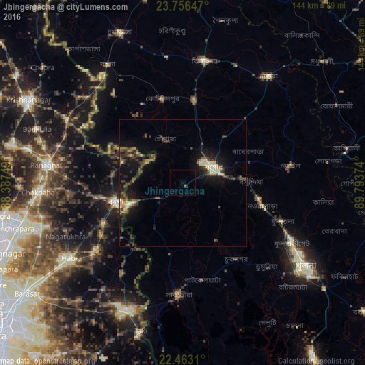
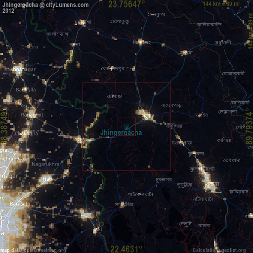
Analysis of Jhingergācha night lights 2016
Square area 10x10 km:
 0%
0%90-99
0%80-89
0%70-79
0%60-69
0.57%50-59
0.19%40-49
0%30-39
0.38%20-29
0.38%10-19
0%0-9
98.48%Square area 50x50 km:
0.05%90-99
1.03%80-89
0.64%70-79
0.53%60-69
0.86%50-59
1.08%40-49
1.8%30-39
1.54%20-29
1.75%10-19
6.33%0-9
84.38%Clear (daylight) street map image can be seen on geolist.org.
Map coordinates:
23° 45' 23.3" North, 88° 23' 15" East
23° 6' 40.8" North, 89° 5' 26.2" East
22° 27' 47.2" North, 89° 47' 37.5" East
Some cities around Jhingergācha sort by population:
• Jessore
14.2 km =8.8 mi,  62°
62°
• Sātkhira
44.9 km =27.9 mi,  182°
182°
• Bangaon, IN
27.6 km =17.1 mi,  254°
254°
• Narail
41.6 km =25.8 mi,  83°
83°
• Kālīganj
33.5 km =20.8 mi,  8°
8°
• Gobārdānga, IN
43.1 km =26.8 mi,  232°
232°
• Bhātpāra Abhaynagar
37.3 km =23.2 mi,  106°
106°
• Kesabpur
26.3 km =16.3 mi,  149°
149°
1185204 (p: 41,957)
Sources (retrieved 2019-11-25):
» Earth at Night: Flat Maps 2012, 2016