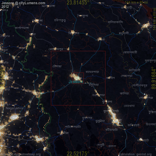
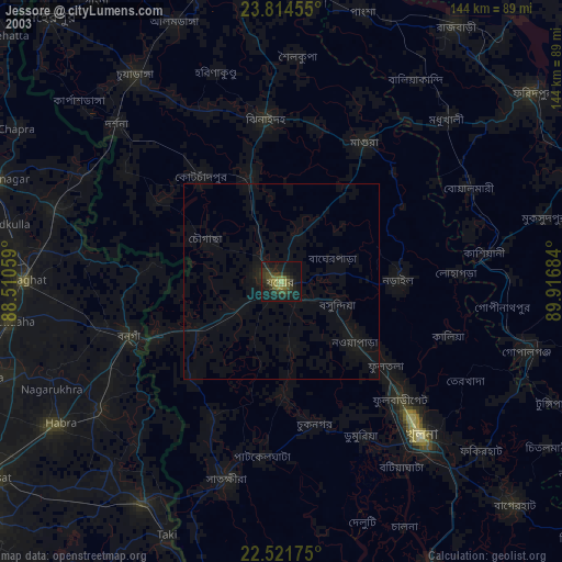
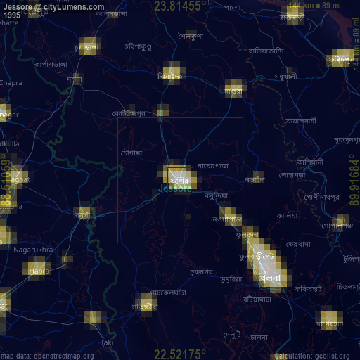
Jessore night lights from space
Night Light of Jessore (Khulna) from space (Bangladesh) Src. Average luminocity for 10x10km area is 42.0511% and for 50x50km: 3.6252%.
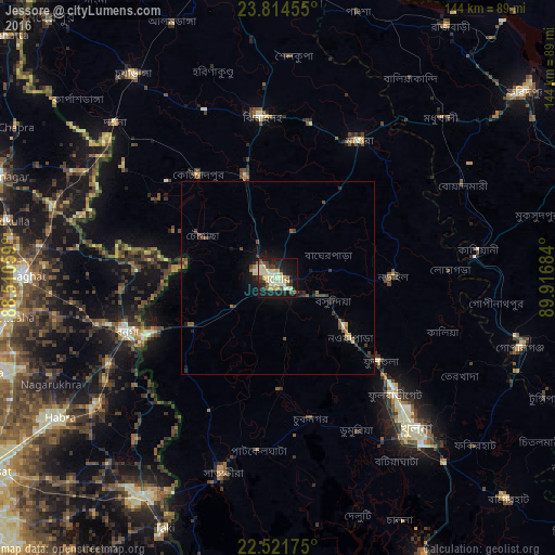
Analysis of Jessore night lights 2016
Square area 10x10 km:
 0.95%
0.95%90-99
16.67%80-89
7.39%70-79
6.44%60-69
0.19%50-59
3.41%40-49
5.68%30-39
7.39%20-29
6.63%10-19
36.17%0-9
9.09%Square area 50x50 km:
0.06%90-99
0.85%80-89
0.38%70-79
0.39%60-69
0.24%50-59
0.51%40-49
0.67%30-39
0.73%20-29
0.73%10-19
2.97%0-9
92.46%Clear (daylight) street map image can be seen on geolist.org.
Map coordinates:
23° 48' 52.4" North, 88° 30' 38.1" East
23° 10' 11" North, 89° 12' 49.4" East
22° 31' 18.3" North, 89° 55' 0.6" East
Some cities around Jessore sort by population:
• Sātkhira
53.3 km =33.1 mi,  195°
195°
• Bangaon, IN
41.5 km =25.8 mi,  250°
250°
• Narail
28.8 km =17.9 mi,  93°
93°
• Kālīganj
27.8 km =17.3 mi,  343°
343°
• Bhātpāra Abhaynagar
28.8 km =17.9 mi,  126°
126°
• Jhingergācha
14.2 km =8.8 mi,  242°
242°
• Kālia
44.9 km =27.9 mi,  108°
108°
• Kesabpur
29.2 km =18.1 mi,  178°
178°
1336140 (p: 243,987)
Sources (retrieved 2019-11-25):
» NASA, Earths city lights 1995
» NASA city lights 2003
» Earth at Night: Flat Maps 2012, 2016