Dinājpur night lights from space
Night Light of Dinājpur (Rangpur Division) from space (Bangladesh) Src. Average luminocity for 10x10km area is 36.6042% and for 50x50km: 4.5084%.
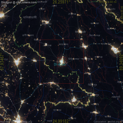
Analysis of Dinājpur night lights 2016
Square area 10x10 km:
 7.95%
7.95%90-99
9.28%80-89
3.79%70-79
0.95%60-69
1.52%50-59
7.39%40-49
1.89%30-39
4.17%20-29
8.14%10-19
40.91%0-9
14.02%Square area 50x50 km:
0.43%90-99
0.59%80-89
0.43%70-79
0.19%60-69
0.35%50-59
0.76%40-49
1.09%30-39
1.11%20-29
1.05%10-19
3.09%0-9
90.9%Clear (daylight) street map image can be seen on geolist.org.
Map coordinates:
26° 15' 35" North, 87° 56' 4.8" East
25° 37' 38.8" North, 88° 38' 16" East
24° 59' 30.6" North, 89° 20' 27.3" East
Some cities around Dinājpur sort by population:
• Saidpur
30.4 km =18.9 mi,  56°
56°
• Bālurghāt, IN
47.3 km =29.4 mi,  162°
162°
• Gangārāmpur, IN
27.4 km =17 mi,  203°
203°
• Kāliyāganj, IN
31.2 km =19.4 mi,  271°
271°
• Parbatipur
29.7 km =18.5 mi,  82°
82°
• Pīrgaaj
37.7 km =23.4 mi,  312°
312°
• Badarganj
42 km =26.1 mi, 82°
• Daulatpur, IN
45.6 km =28.3 mi,  222°
222°
1203891 (p: 206,234)
Sources (retrieved 2019-11-25):
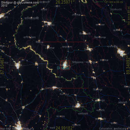
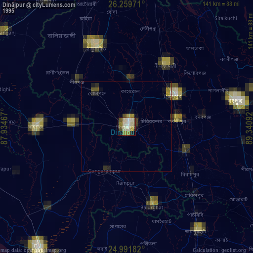
» NASA, Earths city lights 1995
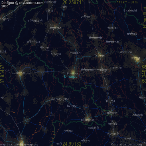
» NASA city lights 2003
» Earth at Night: Flat Maps 2012, 2016