Shamkhor night lights from space
Night Light of Shamkhor (Şǝmkir) from space (Azerbaijan) Src. Average luminocity for 10x10km area is 21.6922% and for 50x50km: 2.8564%.
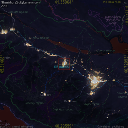

Analysis of Shamkhor night lights 2016
Square area 10x10 km:
 1.87%
1.87%90-99
1.7%80-89
1.36%70-79
3.91%60-69
6.29%50-59
5.95%40-49
0.68%30-39
2.04%20-29
2.21%10-19
19.73%0-9
54.25%Square area 50x50 km:
0.07%90-99
0.14%80-89
0.22%70-79
0.33%60-69
0.45%50-59
0.63%40-49
0.64%30-39
0.66%20-29
1.08%10-19
2.19%0-9
93.59%Clear (daylight) street map image can be seen on geolist.org.
Map coordinates:
41° 21' 34.7" North, 45° 18' 52.8" East
40° 49' 47.1" North, 46° 1' 4.1" East
40° 17' 44.1" North, 46° 43' 15.3" East
Some cities around Shamkhor sort by population:
• Ganja
33.2 km =20.6 mi,  119°
119°
• Yelenendorf
37.1 km =23.1 mi,  136°
136°
• Tovuz
37.4 km =23.2 mi,  298°
298°
• Yukhary-Dashkesan
34.4 km =21.4 mi,  170°
170°
• Kyadabek
33.6 km =20.9 mi,  211°
211°
• Dzagam
13.8 km =8.6 mi,  306°
306°
• Samux
33.7 km =20.9 mi,  102°
102°
• Qarayeri
25.4 km =15.8 mi, 100°
585152 (p: 35,421)
Sources (retrieved 2019-11-25):
» Earth at Night: Flat Maps 2012, 2016