Tovuz night lights from space
Night Light of Tovuz from space (Azerbaijan) Src. Average luminocity for 10x10km area is 7.7466% and for 50x50km: 1.8639%.
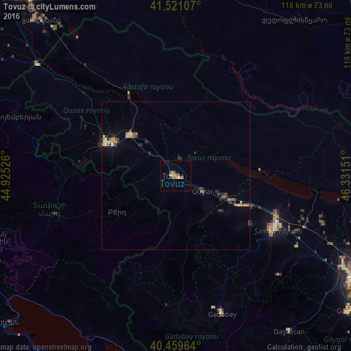
Analysis of Tovuz night lights 2016
Square area 10x10 km:
 0%
0%90-99
0%80-89
1.87%70-79
0.85%60-69
2.04%50-59
3.06%40-49
1.53%30-39
0.17%20-29
1.02%10-19
0%0-9
89.46%Square area 50x50 km:
0.03%90-99
0.15%80-89
0.25%70-79
0.27%60-69
0.29%50-59
0.44%40-49
0.36%30-39
0.32%20-29
0.42%10-19
0.52%0-9
96.94%Clear (daylight) street map image can be seen on geolist.org.
Map coordinates:
41° 31' 15.9" North, 44° 55' 30.9" East
40° 59' 33" North, 45° 37' 42.2" East
40° 27' 34.7" North, 46° 19' 53.4" East
Some cities around Tovuz sort by population:
• Shamkhor
37.4 km =23.2 mi,  118°
118°
• Qazax
24.7 km =15.3 mi,  296°
296°
• Ijevan, AM
42.2 km =26.2 mi,  252°
252°
• Aghstafa
20.3 km =12.6 mi,  313°
313°
• Kyadabek
49.4 km =30.7 mi,  161°
161°
• Berd, AM
23.6 km =14.7 mi,  238°
238°
• Dzagam
23.8 km =14.8 mi,  114°
114°
• Chambarak, AM
49.7 km =30.9 mi,  207°
207°
584821 (p: 12,626)
Sources (retrieved 2019-11-25):
» Earth at Night: Flat Maps 2012, 2016