Ganja night lights from space
Night Light of Ganja (Gǝncǝ) from space (Azerbaijan) Src. Average luminocity for 10x10km area is 65.9854% and for 50x50km: 5.6997%.
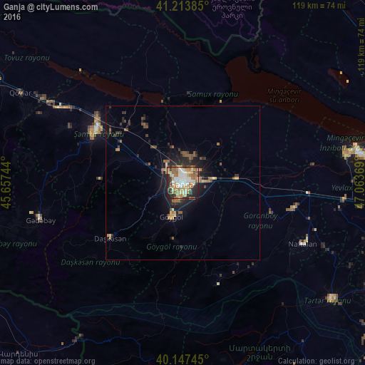
Analysis of Ganja night lights 2016
Square area 10x10 km:
 14.29%
90-99
13.31%80-89
11.36%70-79
10.23%60-69
12.66%50-59
9.42%40-49
4.87%30-39
5.84%20-29
13.96%10-19
4.06%0-9
0%Square area 50x50 km:
0.59%90-99
0.7%80-89
0.61%70-79
0.78%60-69
0.9%50-59
1.12%40-49
0.79%30-39
0.78%20-29
2.09%10-19
3.64%0-9
88%Clear (daylight) street map image can be seen on geolist.org.
Map coordinates:
41° 12' 49.9" North, 45° 39' 26.8" East
40° 40' 58" North, 46° 21' 38" East
40° 8' 50.8" North, 47° 3' 49.3" East
Some cities around Ganja sort by population:
• Shamkhor
33.2 km =20.6 mi,  299°
299°
• Yelenendorf
11.3 km =7 mi,  198°
198°
• Yukhary-Dashkesan
29.4 km =18.3 mi,  233°
233°
• Goranboy
37.1 km =23.1 mi,  102°
102°
• Naftalan
43.4 km =27 mi,  116°
116°
• Qızılhacılı
43.6 km =27.1 mi,  105°
105°
• Samux
10 km =6.2 mi,  23°
23°
• Qarayeri
12.2 km =7.6 mi,  341°
341°
586523 (p: 313,300)
Sources (retrieved 2019-11-25):
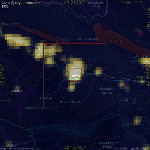
» NASA, Earths city lights 1995
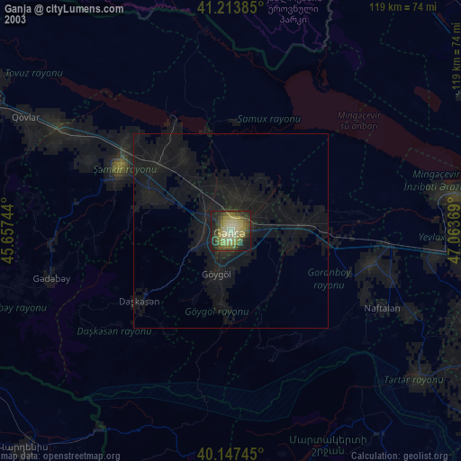
» NASA city lights 2003
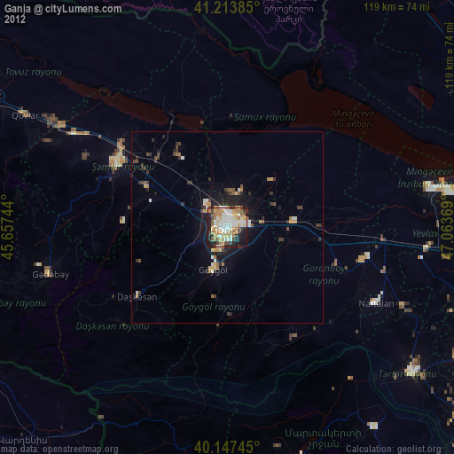
» Earth at Night: Flat Maps 2012, 2016