Kyadabek night lights from space
Night Light of Kyadabek (Gǝdǝbǝy) from space (Azerbaijan) Src. Average luminocity for 10x10km area is 5.1542% and for 50x50km: 0.3877%.
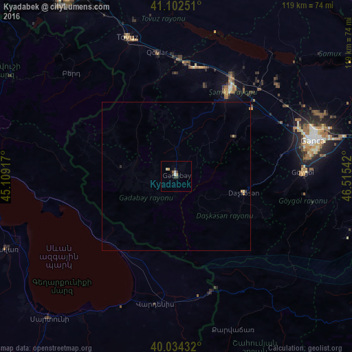
Analysis of Kyadabek night lights 2016
Square area 10x10 km:
 0.65%
0.65%90-99
1.14%80-89
0.32%70-79
1.14%60-69
0.16%50-59
0.49%40-49
0.65%30-39
1.95%20-29
0.65%10-19
0.49%0-9
92.37%Square area 50x50 km:
0.03%90-99
0.07%80-89
0.05%70-79
0.1%60-69
0.02%50-59
0.02%40-49
0.03%30-39
0.14%20-29
0.08%10-19
0.04%0-9
99.45%Clear (daylight) street map image can be seen on geolist.org.
Map coordinates:
41° 6' 9" North, 45° 6' 33" East
40° 34' 14" North, 45° 48' 44.2" East
40° 2' 3.6" North, 46° 30' 55.5" East
Some cities around Kyadabek sort by population:
• Ganja
47.9 km =29.8 mi,  74°
74°
• Shamkhor
33.6 km =20.9 mi,  31°
31°
• Yelenendorf
42.8 km =26.6 mi,  87°
87°
• Vardenis, AM
43.6 km =27.1 mi,  189°
189°
• Yukhary-Dashkesan
23.4 km =14.5 mi,  102°
102°
• Dzagam
37.5 km =23.3 mi,  9°
9°
• Chambarak, AM
38.7 km =24 mi,  274°
274°
• Qarayeri
48.6 km =30.2 mi,  60°
60°
586573 (p: 8,657)
Sources (retrieved 2019-11-25):
» Earth at Night: Flat Maps 2012, 2016