Lökbatan night lights from space
Night Light of Lökbatan (Baki) from space (Azerbaijan) Src. Average luminocity for 10x10km area is 42.8554% and for 50x50km: 27.6568%.
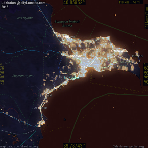
Analysis of Lökbatan night lights 2016
Square area 10x10 km:
 2.89%
2.89%90-99
6.29%80-89
8.16%70-79
5.44%60-69
7.65%50-59
3.91%40-49
7.14%30-39
8.84%20-29
24.83%10-19
24.15%0-9
0.68%Square area 50x50 km:
5.43%90-99
5.23%80-89
3.99%70-79
3.99%60-69
4.23%50-59
2.99%40-49
3.24%30-39
4.38%20-29
5.34%10-19
11.33%0-9
49.84%Clear (daylight) street map image can be seen on geolist.org.
Map coordinates:
40° 51' 34.3" North, 49° 1' 50.3" East
40° 19' 32.2" North, 49° 44' 1.5" East
39° 47' 14.7" North, 50° 26' 12.8" East
Some cities around Lökbatan sort by population:
• Baku
14.6 km =9.1 mi,  66°
66°
• Qaraçuxur
21.8 km =13.5 mi, 68°
• Bilajari
14.5 km =9 mi,  24°
24°
• Khirdalan
13.7 km =8.5 mi,  7°
7°
• Binagadi
17.5 km =10.9 mi,  27°
27°
• Badamdar
6.2 km =3.9 mi, 74°
• Qobu
9 km =5.6 mi,  348°
348°
• Khodzhi-Gasan
10.2 km =6.3 mi, 17°
585630 (p: 30,694)
Sources (retrieved 2019-11-25):
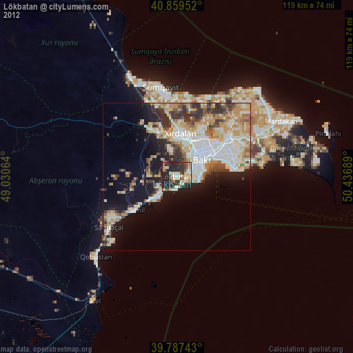
» Earth at Night: Flat Maps 2012, 2016