Qaraçuxur night lights from space
Night Light of Qaraçuxur (Baki) from space (Azerbaijan) Src. Average luminocity for 10x10km area is 86.0459% and for 50x50km: 35.6741%.
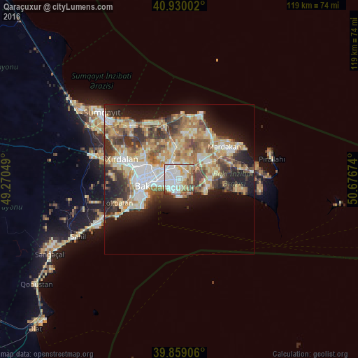
Analysis of Qaraçuxur night lights 2016
Square area 10x10 km:
 35.71%
90-99
23.3%80-89
12.93%70-79
8.67%60-69
5.95%50-59
7.14%40-49
4.76%30-39
1.36%20-29
0.17%10-19
0%0-9
0%Square area 50x50 km:
6.06%90-99
6.76%80-89
5.67%70-79
5.25%60-69
6.34%50-59
4.91%40-49
4.59%30-39
5.43%20-29
6.57%10-19
11.72%0-9
36.7%Clear (daylight) street map image can be seen on geolist.org.
Map coordinates:
40° 55' 48.1" North, 49° 16' 13.8" East
40° 23' 48" North, 49° 58' 25" East
39° 51' 32.6" North, 50° 40' 36.3" East
Some cities around Qaraçuxur sort by population:
• Baku
7.2 km =4.5 mi,  253°
253°
• Bakıxanov
2.5 km =1.6 mi,  347°
347°
• Amirdzhan
3.4 km =2.1 mi,  14°
14°
• Zabrat
9.4 km =5.8 mi,  343°
343°
• Sabunçu
5.5 km =3.4 mi, 337°
• Yeni Suraxanı
6.5 km =4 mi,  54°
54°
• Balakhani
8.7 km =5.4 mi,  328°
328°
• Ramana
5.1 km =3.2 mi, 6°
585103 (p: 72,989)
Sources (retrieved 2019-11-25):
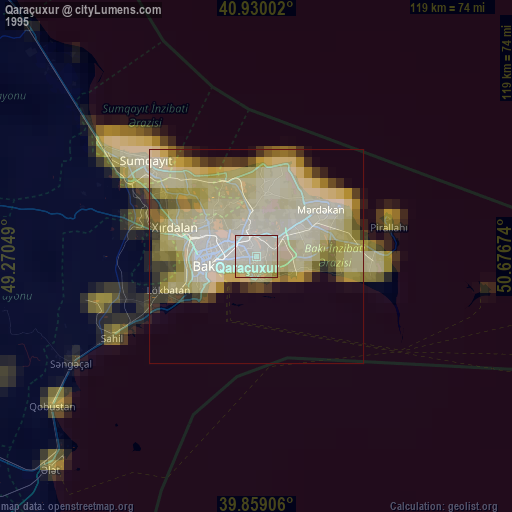
» NASA, Earths city lights 1995
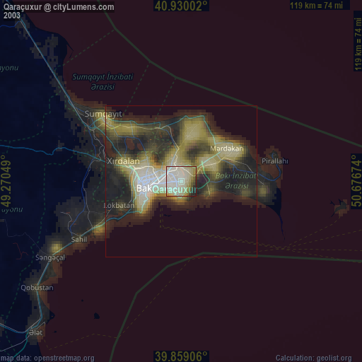
» NASA city lights 2003
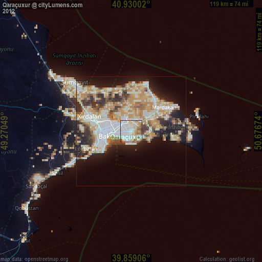
» Earth at Night: Flat Maps 2012, 2016