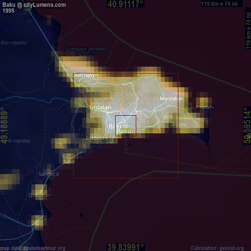
Baku night lights from space
Night Light of Baku (Baki) from space (Azerbaijan) Src. Average luminocity for 10x10km area is 82.6122% and for 50x50km: 37.4495%.

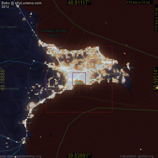
Analysis of Baku night lights 2016
Square area 10x10 km:
 46.77%
90-99
19.73%80-89
1.87%70-79
2.38%60-69
5.61%50-59
4.93%40-49
7.14%30-39
6.63%20-29
4.93%10-19
0%0-9
0%Square area 50x50 km:
6.38%90-99
7.32%80-89
5.98%70-79
5.54%60-69
6.59%50-59
5.17%40-49
4.67%30-39
5.48%20-29
7.06%10-19
11.77%0-9
34.05%Clear (daylight) street map image can be seen on geolist.org.
Map coordinates:
40° 54' 40.2" North, 49° 11' 20" East
40° 22' 39.6" North, 49° 53' 31.2" East
39° 50' 23.7" North, 50° 35' 42.5" East
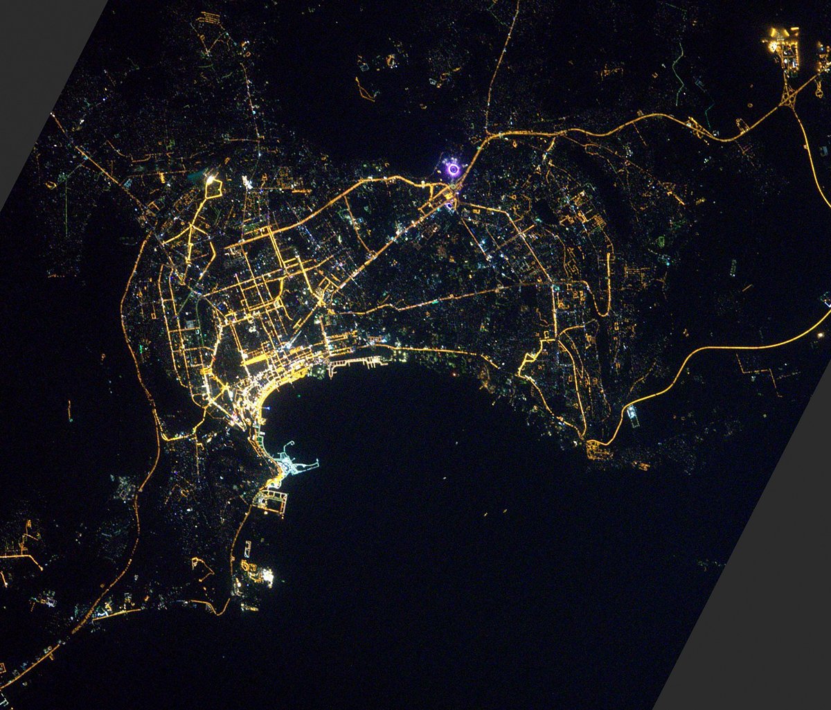
Fantastic image of Baku from space taken by astronauts [src2], but I don't have information about it's orientation, scale or angle. If necessary, it was rotated manually, so North points approximately to upper direction. Click to zoom in:
Some cities around Baku sort by population:
• Qaraçuxur
7.2 km =4.5 mi,  73°
73°
• Bakıxanov
7.8 km =4.8 mi,  54°
54°
• Bilajari
10.4 km =6.5 mi,  315°
315°
• Amirdzhan
9.5 km =5.9 mi,  55°
55°
• Sabunçu
8.6 km =5.3 mi,  33°
33°
• Badamdar
8.5 km =5.3 mi,  240°
240°
• Balakhani
9.8 km =6.1 mi,  13°
13°
• Ramana
10.4 km =6.5 mi, 46°
587084 (p: 1,116,513)
Sources (retrieved 2019-11-25):
» NASA, Earths city lights 1995
» NASA city lights 2003
» Earth at Night: Flat Maps 2012, 2016
Src.2: Thomas Pesquet, Twitter/@Thom_astro, 2017-02-28