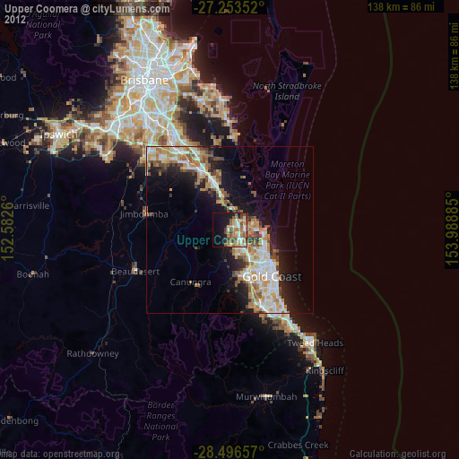
Upper Coomera night lights from space
Night Light of Upper Coomera (Queensland) from space (Australia) Src. Average luminocity for 10x10km area is 44.9394% and for 50x50km: 19.6605%.

Analysis of Upper Coomera night lights 2016
Square area 10x10 km:
 4.73%
4.73%90-99
7.01%80-89
5.11%70-79
5.3%60-69
18.75%50-59
6.44%40-49
5.68%30-39
3.6%20-29
7.39%10-19
22.35%0-9
13.64%Square area 50x50 km:
3.16%90-99
3.42%80-89
1.74%70-79
1.79%60-69
6.6%50-59
1.97%40-49
2.15%30-39
2.63%20-29
4.69%10-19
9.6%0-9
62.24%Clear (daylight) street map image can be seen on geolist.org.
Map coordinates:
27° 15' 12.7" South, 152° 34' 57.4" East
27° 52' 36.6" South, 153° 17' 8.6" East
28° 29' 47.7" South, 153° 59' 19.9" East
Some cities around Upper Coomera sort by population:
• Helensvale
6.5 km =4 mi,  134°
134°
• Pacific Pines
7.6 km =4.7 mi,  158°
158°
• Coomera
6.4 km =4 mi,  54°
54°
• Oxenford
3.1 km =1.9 mi,  119°
119°
• Hope Island
6.5 km =4 mi,  83°
83°
• Coombabah
9.2 km =5.7 mi,  114°
114°
• Pimpama
6.8 km =4.2 mi,  11°
11°
• Maudsland
8.3 km =5.2 mi,  192°
192°
2145461 (p: 24,956)
Sources (retrieved 2019-11-25):
» Earth at Night: Flat Maps 2012, 2016