Pimpama night lights from space
Night Light of Pimpama (Queensland) from space (Australia) Src. Average luminocity for 10x10km area is 33.5057% and for 50x50km: 20.4213%.
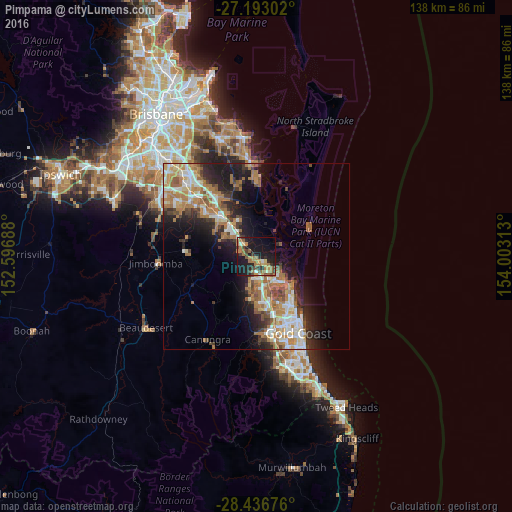
Analysis of Pimpama night lights 2016
Square area 10x10 km:
 1.52%
1.52%90-99
2.46%80-89
3.79%70-79
2.65%60-69
14.96%50-59
4.36%40-49
4.17%30-39
6.63%20-29
9.28%10-19
36.74%0-9
13.45%Square area 50x50 km:
2.96%90-99
3.38%80-89
2.04%70-79
2.27%60-69
6.89%50-59
2.07%40-49
2.19%30-39
2.63%20-29
4.94%10-19
10.45%0-9
60.17%Clear (daylight) street map image can be seen on geolist.org.
Map coordinates:
27° 11' 34.9" South, 152° 35' 48.8" East
27° 49' 0" South, 153° 18' 0" East
28° 26' 12.3" South, 154° 0' 11.3" East
Some cities around Pimpama sort by population:
• Upper Coomera
6.8 km =4.2 mi,  191°
191°
• Helensvale
11.7 km =7.3 mi,  164°
164°
• Ormeau
7.8 km =4.8 mi,  313°
313°
• Coomera
4.8 km =3 mi,  127°
127°
• Oxenford
8.3 km =5.2 mi,  171°
171°
• Hope Island
7.8 km =4.8 mi,  139°
139°
• Coombabah
12.6 km =7.8 mi,  146°
146°
• Paradise Point
12 km =7.5 mi, 130°
2153168 (p: 9,396)
Sources (retrieved 2019-11-25):
» Earth at Night: Flat Maps 2012, 2016