Oxenford night lights from space
Night Light of Oxenford (Queensland) from space (Australia) Src. Average luminocity for 10x10km area is 59.9602% and for 50x50km: 18.7682%.
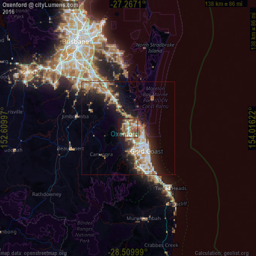
Analysis of Oxenford night lights 2016
Square area 10x10 km:
 7.95%
7.95%90-99
11.17%80-89
5.68%70-79
4.55%60-69
27.08%50-59
10.98%40-49
11.17%30-39
4.73%20-29
5.68%10-19
10.98%0-9
0%Square area 50x50 km:
3.1%90-99
3.21%80-89
1.61%70-79
1.56%60-69
6.23%50-59
1.97%40-49
2.16%30-39
2.56%20-29
4.57%10-19
9.45%0-9
63.59%Clear (daylight) street map image can be seen on geolist.org.
Map coordinates:
27° 16' 1.6" South, 152° 36' 35.9" East
27° 53' 25.2" South, 153° 18' 47.1" East
28° 30' 36" South, 154° 0' 58.4" East
Some cities around Oxenford sort by population:
• Upper Coomera
3.1 km =1.9 mi,  299°
299°
• Helensvale
3.7 km =2.3 mi,  148°
148°
• Pacific Pines
5.5 km =3.4 mi,  178°
178°
• Coomera
5.8 km =3.6 mi,  25°
25°
• Hope Island
4.4 km =2.7 mi,  59°
59°
• Coombabah
6.1 km =3.8 mi,  111°
111°
• Arundel
7.2 km =4.5 mi,  137°
137°
• Paradise Point
7.9 km =4.9 mi,  87°
87°
7302638 (p: 11,797)
Sources (retrieved 2019-11-25):
» Earth at Night: Flat Maps 2012, 2016