Pacific Pines night lights from space
Night Light of Pacific Pines (Queensland) from space (Australia) Src. Average luminocity for 10x10km area is 52.4773% and for 50x50km: 17.5097%.
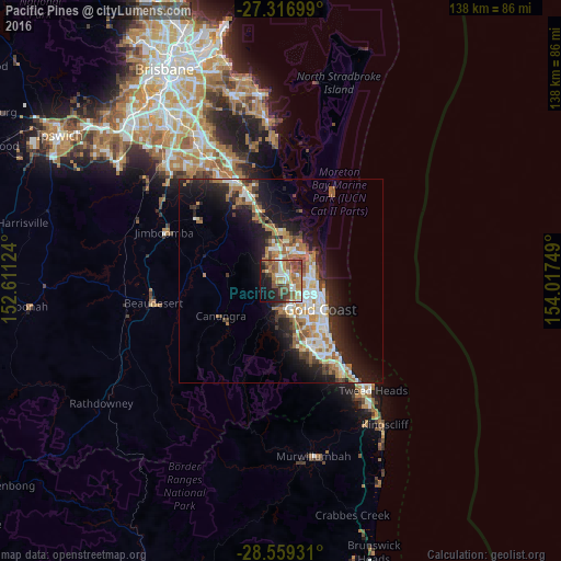
Analysis of Pacific Pines night lights 2016
Square area 10x10 km:
 5.49%
5.49%90-99
8.71%80-89
4.36%70-79
4.55%60-69
19.89%50-59
13.83%40-49
10.04%30-39
6.25%20-29
9.09%10-19
14.58%0-9
3.22%Square area 50x50 km:
2.88%90-99
3.09%80-89
1.55%70-79
1.28%60-69
5.23%50-59
1.81%40-49
2.03%30-39
2.38%20-29
4.75%10-19
10.47%0-9
64.54%Clear (daylight) street map image can be seen on geolist.org.
Map coordinates:
27° 19' 1.2" South, 152° 36' 40.5" East
27° 56' 23.8" South, 153° 18' 51.7" East
28° 33' 33.5" South, 154° 1' 3" East
Some cities around Pacific Pines sort by population:
• Helensvale
3 km =1.9 mi,  36°
36°
• Nerang
5.9 km =3.7 mi,  158°
158°
• Oxenford
5.5 km =3.4 mi,  358°
358°
• Coombabah
6.4 km =4 mi,  59°
59°
• Arundel
4.8 km =3 mi,  86°
86°
• Parkwood
5.1 km =3.2 mi,  108°
108°
• Molendinar
5.9 km =3.7 mi,  129°
129°
• Maudsland
4.8 km =3 mi,  256°
256°
8348920 (p: 16,605)
Sources (retrieved 2019-11-25):
» Earth at Night: Flat Maps 2012, 2016