Helensvale night lights from space
Night Light of Helensvale (Queensland) from space (Australia) Src. Average luminocity for 10x10km area is 65.6648% and for 50x50km: 17.8471%.
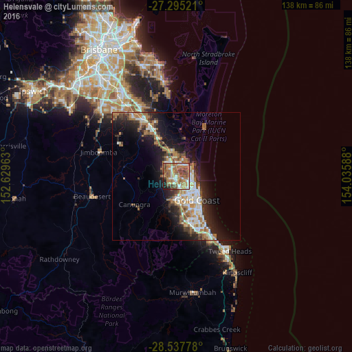
Analysis of Helensvale night lights 2016
Square area 10x10 km:
 7.95%
7.95%90-99
11.93%80-89
6.25%70-79
7.2%60-69
30.11%50-59
15.53%40-49
12.31%30-39
2.65%20-29
3.98%10-19
2.08%0-9
0%Square area 50x50 km:
2.92%90-99
3.1%80-89
1.56%70-79
1.35%60-69
5.59%50-59
1.86%40-49
2.17%30-39
2.45%20-29
4.71%10-19
9.78%0-9
64.5%Clear (daylight) street map image can be seen on geolist.org.
Map coordinates:
27° 17' 42.8" South, 152° 37' 46.7" East
27° 55' 5.8" South, 153° 19' 57.9" East
28° 32' 16" South, 154° 2' 9.2" East
Some cities around Helensvale sort by population:
• Upper Coomera
6.5 km =4 mi,  314°
314°
• Pacific Pines
3 km =1.9 mi,  216°
216°
• Oxenford
3.7 km =2.3 mi,  328°
328°
• Hope Island
5.6 km =3.5 mi,  19°
19°
• Coombabah
3.8 km =2.4 mi,  77°
77°
• Arundel
3.7 km =2.3 mi,  125°
125°
• Runaway Bay
6.4 km =4 mi,  85°
85°
• Parkwood
5 km =3.1 mi,  143°
143°
7576707 (p: 16,839)
Sources (retrieved 2019-11-25):
» Earth at Night: Flat Maps 2012, 2016