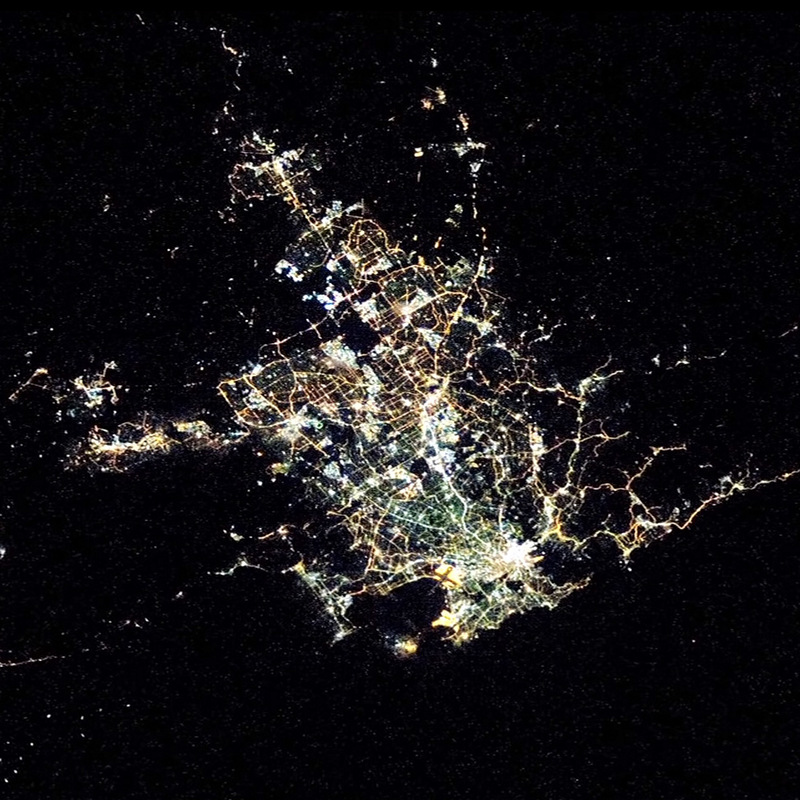
Sydney night lights from space
Night Light of Sydney (New South Wales) from space (Australia) Src. Average luminocity for 10x10km area is 88.8986% and for 50x50km: 41.4471%.
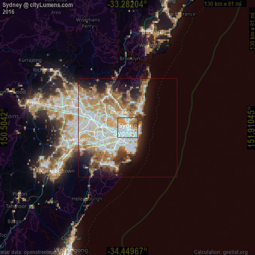

Analysis of Sydney night lights 2016
Square area 10x10 km:
 42.31%
90-99
23.78%80-89
3.32%70-79
17.13%60-69
7.34%50-59
2.45%40-49
3.15%30-39
0.52%20-29
0%10-19
0%0-9
0%Square area 50x50 km:
9.79%90-99
10.47%80-89
5.11%70-79
6.62%60-69
7.93%50-59
3.65%40-49
2.47%30-39
3.54%20-29
4.91%10-19
8.84%0-9
36.67%Clear (daylight) street map image can be seen on geolist.org.
Map coordinates:
33° 16' 55.3" South, 150° 30' 15.1" East
33° 52' 4.3" South, 151° 12' 26.4" East
34° 26' 58.8" South, 151° 54' 37.6" East
Fantastic image of Sydney from space taken by astronauts [src2], but I don't have information about it's orientation, scale or angle. If necessary, it was rotated manually, so North points approximately to upper direction. Click to zoom in:
Some cities around Sydney sort by population:
• Surry Hills
1.8 km =1.1 mi,  163°
163°
• Pyrmont
1.2 km =0.7 mi,  259°
259°
• Potts Point
1.7 km =1.1 mi,  86°
86°
• Darlinghurst
1.7 km =1.1 mi,  139°
139°
• Haymarket
1.2 km =0.7 mi,  188°
188°
• Chippendale
2.3 km =1.4 mi,  203°
203°
• Ultimo
1.4 km =0.9 mi,  221°
221°
• Elizabeth Bay
1.9 km =1.2 mi,  103°
103°
2147714 (p: 4,627,345)
Sources (retrieved 2019-11-25):
» NASA, Earths city lights 1995
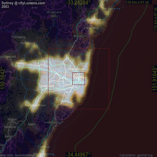
» NASA city lights 2003
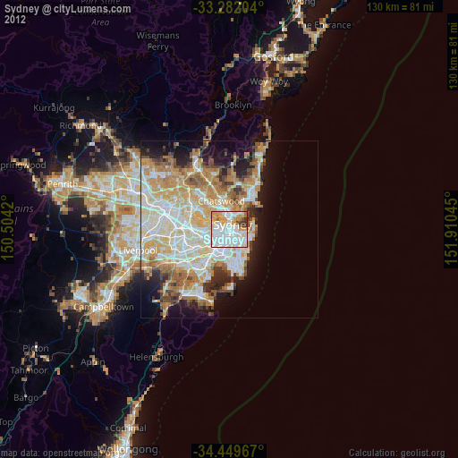
» Earth at Night: Flat Maps 2012, 2016
Src.2: NASA.gov