Ultimo night lights from space
Night Light of Ultimo (New South Wales) from space (Australia) Src. Average luminocity for 10x10km area is 91.3024% and for 50x50km: 42.2927%.
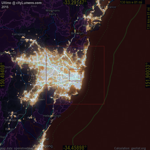
Analysis of Ultimo night lights 2016
Square area 10x10 km:
 47.2%
47.2%90-99
24.3%80-89
5.24%70-79
13.29%60-69
6.47%50-59
1.22%40-49
2.27%30-39
0%20-29
0%10-19
0%0-9
0%Square area 50x50 km:
10.04%90-99
10.79%80-89
5.39%70-79
6.67%60-69
7.88%50-59
3.73%40-49
2.52%30-39
3.49%20-29
4.96%10-19
8.68%0-9
35.85%Clear (daylight) street map image can be seen on geolist.org.
Map coordinates:
33° 17' 29.3" South, 150° 29' 38.7" East
33° 52' 38" South, 151° 11' 49.9" East
34° 27' 32.3" South, 151° 54' 1.2" East
Some cities around Ultimo sort by population:
• Sydney
1.4 km =0.9 mi,  41°
41°
• Sydney Central Business District
1.7 km =1.1 mi, 35°
• Surry Hills
1.6 km =1 mi,  116°
116°
• Pyrmont
0.9 km =0.6 mi,  340°
340°
• Redfern
1.8 km =1.1 mi,  159°
159°
• Glebe
1.2 km =0.7 mi,  261°
261°
• Haymarket
0.8 km =0.5 mi,  102°
102°
• Chippendale
1.1 km =0.7 mi,  178°
178°
2207754 (p: 8,857)
Sources (retrieved 2019-11-25):
» Earth at Night: Flat Maps 2012, 2016