South Granville night lights from space
Night Light of South Granville (New South Wales) from space (Australia) Src. Average luminocity for 10x10km area is 95.9056% and for 50x50km: 60.0735%.
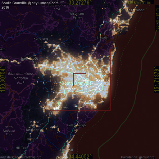
Analysis of South Granville night lights 2016
Square area 10x10 km:
 40.91%
90-99
41.96%80-89
13.99%70-79
3.15%60-69
0%50-59
0%40-49
0%30-39
0%20-29
0%10-19
0%0-9
0%Square area 50x50 km:
13.91%90-99
15.01%80-89
7.76%70-79
9.48%60-69
11%50-59
6%40-49
4.35%30-39
5.98%20-29
7.83%10-19
9.65%0-9
9.02%Clear (daylight) street map image can be seen on geolist.org.
Map coordinates:
33° 16' 21.9" South, 150° 18' 27.1" East
33° 51' 31.1" South, 151° 0' 38.4" East
34° 26' 25.9" South, 151° 42' 49.6" East
Some cities around South Granville sort by population:
• Auburn
2.3 km =1.4 mi,  65°
65°
• Merrylands
3.8 km =2.4 mi,  318°
318°
• Granville
2 km =1.2 mi,  351°
351°
• Lidcombe
2.8 km =1.7 mi,  103°
103°
• Chester Hill
2.5 km =1.6 mi,  204°
204°
• Berala
2.6 km =1.6 mi,  124°
124°
• Sefton
3.2 km =2 mi,  180°
180°
• Fairfield East
3.8 km =2.4 mi,  251°
251°
11978587 (p: 5,484)
Sources (retrieved 2019-11-25):
» Earth at Night: Flat Maps 2012, 2016