Auburn night lights from space
Night Light of Auburn (New South Wales) from space (Australia) Src. Average luminocity for 10x10km area is 95.3916% and for 50x50km: 60.014%.
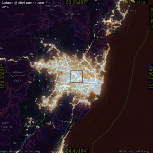
Analysis of Auburn night lights 2016
Square area 10x10 km:
 40.91%
90-99
38.46%80-89
16.78%70-79
3.85%60-69
0%50-59
0%40-49
0%30-39
0%20-29
0%10-19
0%0-9
0%Square area 50x50 km:
13.75%90-99
15.09%80-89
7.82%70-79
9.49%60-69
11.17%50-59
5.95%40-49
4.22%30-39
5.84%20-29
8.1%10-19
9.16%0-9
9.41%Clear (daylight) street map image can be seen on geolist.org.
Map coordinates:
33° 15' 50.7" South, 150° 19' 48.8" East
33° 51' 0" South, 151° 1' 60" East
34° 25' 55" South, 151° 44' 11.3" East
Some cities around Auburn sort by population:
• Granville
2.6 km =1.6 mi,  293°
293°
• Lidcombe
1.7 km =1.1 mi,  159°
159°
• Berala
2.4 km =1.5 mi,  178°
178°
• Homebush West
3.4 km =2.1 mi,  114°
114°
• Rydalmere
4 km =2.5 mi,  5°
5°
• Newington
2.8 km =1.7 mi,  52°
52°
• Harris Park
3.8 km =2.4 mi,  322°
322°
• South Granville
2.3 km =1.4 mi,  245°
245°
2177513 (p: 37,245)
Sources (retrieved 2019-11-25):
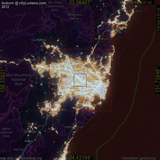
» Earth at Night: Flat Maps 2012, 2016