Lidcombe night lights from space
Night Light of Lidcombe (New South Wales) from space (Australia) Src. Average luminocity for 10x10km area is 94.8024% and for 50x50km: 59.9387%.
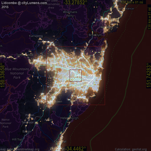
Analysis of Lidcombe night lights 2016
Square area 10x10 km:
 37.94%
90-99
37.76%80-89
19.76%70-79
4.55%60-69
0%50-59
0%40-49
0%30-39
0%20-29
0%10-19
0%0-9
0%Square area 50x50 km:
13.65%90-99
15.07%80-89
7.88%70-79
9.52%60-69
11.18%50-59
5.86%40-49
4.22%30-39
5.8%20-29
8%10-19
9.84%0-9
8.97%Clear (daylight) street map image can be seen on geolist.org.
Map coordinates:
33° 16' 42.7" South, 150° 20' 11.7" East
33° 51' 51.7" South, 151° 2' 22.9" East
34° 26' 46.3" South, 151° 44' 34.2" East
Some cities around Lidcombe sort by population:
• Auburn
1.7 km =1.1 mi,  339°
339°
• Granville
4 km =2.5 mi,  311°
311°
• Berala
1 km =0.6 mi,  212°
212°
• Homebush West
2.5 km =1.6 mi,  85°
85°
• Homebush
4 km =2.5 mi, 93°
• Sefton
3.7 km =2.3 mi,  226°
226°
• Newington
3.6 km =2.2 mi,  26°
26°
• South Granville
2.8 km =1.7 mi,  283°
283°
2160258 (p: 19,791)
Sources (retrieved 2019-11-25):
» Earth at Night: Flat Maps 2012, 2016