Merrylands night lights from space
Night Light of Merrylands (New South Wales) from space (Australia) Src. Average luminocity for 10x10km area is 95.3986% and for 50x50km: 58.5235%.
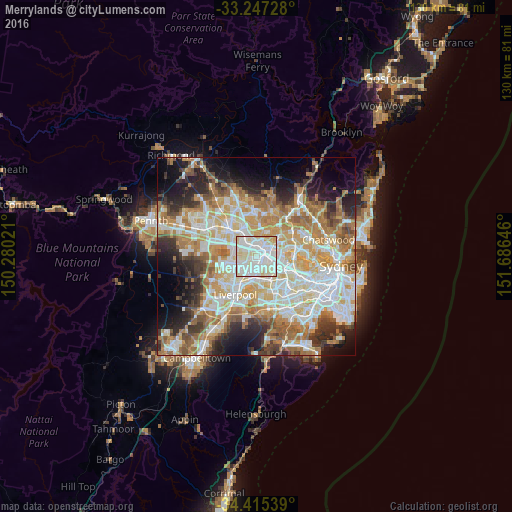
Analysis of Merrylands night lights 2016
Square area 10x10 km:
 38.81%
90-99
41.43%80-89
16.78%70-79
2.97%60-69
0%50-59
0%40-49
0%30-39
0%20-29
0%10-19
0%0-9
0%Square area 50x50 km:
13.59%90-99
14.64%80-89
7.69%70-79
9.44%60-69
10.73%50-59
5.56%40-49
4.1%30-39
5.73%20-29
7.36%10-19
8.94%0-9
12.24%Clear (daylight) street map image can be seen on geolist.org.
Map coordinates:
33° 14' 50.2" South, 150° 16' 48.8" East
33° 49' 60" South, 150° 58' 60" East
34° 24' 55.4" South, 151° 41' 11.3" East
Some cities around Merrylands sort by population:
• Parramatta
2.5 km =1.6 mi,  47°
47°
• Granville
2.4 km =1.5 mi,  109°
109°
• Greystanes
3.6 km =2.2 mi,  287°
287°
• Westmead
3.3 km =2.1 mi,  6°
6°
• Wentworthville
3.3 km =2.1 mi,  334°
334°
• South Wentworthville
2.5 km =1.6 mi,  311°
311°
• Harris Park
2.5 km =1.6 mi,  62°
62°
• South Granville
3.8 km =2.4 mi,  138°
138°
2157995 (p: 29,508)
Sources (retrieved 2019-11-25):
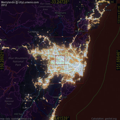
» Earth at Night: Flat Maps 2012, 2016