South Coogee night lights from space
Night Light of South Coogee (New South Wales) from space (Australia) Src. Average luminocity for 10x10km area is 63.514% and for 50x50km: 33.3095%.
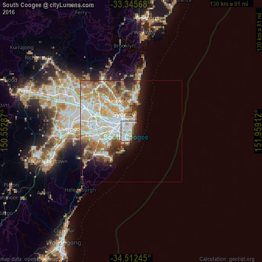
Analysis of South Coogee night lights 2016
Square area 10x10 km:
 22.55%
90-99
24.83%80-89
3.67%70-79
5.24%60-69
1.92%50-59
1.22%40-49
2.97%30-39
2.27%20-29
13.29%10-19
15.73%0-9
6.29%Square area 50x50 km:
8.27%90-99
8.56%80-89
4.15%70-79
5.15%60-69
6.44%50-59
3.06%40-49
2.12%30-39
2.69%20-29
3.05%10-19
4.65%0-9
51.87%Clear (daylight) street map image can be seen on geolist.org.
Map coordinates:
33° 20' 44.4" South, 150° 33' 10.3" East
33° 55' 51.8" South, 151° 15' 21.6" East
34° 30' 44.8" South, 151° 57' 32.8" East
Some cities around South Coogee sort by population:
• Randwick
2 km =1.2 mi,  340°
340°
• Maroubra
3 km =1.9 mi,  224°
224°
• Kingsford
2.7 km =1.7 mi,  286°
286°
• Coogee
1.2 km =0.7 mi,  356°
356°
• Kensington
3.3 km =2.1 mi, 291°
• Bronte
3.4 km =2.1 mi,  15°
15°
• Hillsdale
3.5 km =2.2 mi,  228°
228°
• Malabar
3.5 km =2.2 mi,  192°
192°
9972937 (p: 5,421)
Sources (retrieved 2019-11-25):
» Earth at Night: Flat Maps 2012, 2016