Malabar night lights from space
Night Light of Malabar (New South Wales) from space (Australia) Src. Average luminocity for 10x10km area is 55.7832% and for 50x50km: 31.861%.
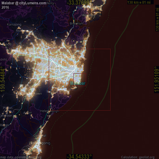
Analysis of Malabar night lights 2016
Square area 10x10 km:
 18.36%
90-99
19.58%80-89
3.32%70-79
2.27%60-69
3.15%50-59
3.15%40-49
4.2%30-39
5.94%20-29
14.86%10-19
16.96%0-9
8.22%Square area 50x50 km:
8.3%90-99
8.55%80-89
4.12%70-79
4.94%60-69
5.48%50-59
2.59%40-49
1.89%30-39
2.22%20-29
2.54%10-19
4.49%0-9
54.88%Clear (daylight) street map image can be seen on geolist.org.
Map coordinates:
33° 22' 37.2" South, 150° 32' 41.4" East
33° 57' 43.8" South, 151° 14' 52.7" East
34° 32' 36" South, 151° 57' 3.9" East
Some cities around Malabar sort by population:
• Maroubra
1.9 km =1.2 mi,  315°
315°
• Kingsford
4.6 km =2.9 mi,  336°
336°
• Coogee
4.7 km =2.9 mi,  8°
8°
• Botany
5.1 km =3.2 mi,  290°
290°
• Matraville
1.5 km =0.9 mi,  264°
264°
• Eastlakes
4.7 km =2.9 mi, 315°
• South Coogee
3.5 km =2.2 mi, 12°
• Hillsdale
2.2 km =1.4 mi,  302°
302°
2159018 (p: 5,403)
Sources (retrieved 2019-11-25):
» Earth at Night: Flat Maps 2012, 2016