Seaforth night lights from space
Night Light of Seaforth (New South Wales) from space (Australia) Src. Average luminocity for 10x10km area is 69.3147% and for 50x50km: 35.8563%.
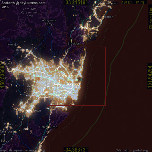
Analysis of Seaforth night lights 2016
Square area 10x10 km:
 11.71%
90-99
13.99%80-89
7.52%70-79
9.62%60-69
27.97%50-59
10.66%40-49
7.87%30-39
6.99%20-29
3.67%10-19
0%0-9
0%Square area 50x50 km:
8.44%90-99
8.96%80-89
4.4%70-79
5.88%60-69
7.19%50-59
3.16%40-49
1.99%30-39
3.05%20-29
4.12%10-19
6.28%0-9
46.54%Clear (daylight) street map image can be seen on geolist.org.
Map coordinates:
33° 12' 54.7" South, 150° 32' 12.1" East
33° 48' 5.2" South, 151° 14' 23.3" East
34° 23' 1.4" South, 151° 56' 34.6" East
Some cities around Seaforth sort by population:
• Cremorne
3.1 km =1.9 mi,  203°
203°
• Balgowlah
1.8 km =1.1 mi,  65°
65°
• Cammeray
3.1 km =1.9 mi,  224°
224°
• Allambie Heights
4 km =2.5 mi,  13°
13°
• Willoughby
3.8 km =2.4 mi,  264°
264°
• Northbridge
2.5 km =1.6 mi,  238°
238°
• Manly Vale
2.8 km =1.7 mi,  47°
47°
• Fairlight
3.2 km =2 mi,  78°
78°
2207834 (p: 6,998)
Sources (retrieved 2019-11-25):
» Earth at Night: Flat Maps 2012, 2016