Mulgrave night lights from space
Night Light of Mulgrave (Victoria) from space (Australia) Src. Average luminocity for 10x10km area is 82.3864% and for 50x50km: 45.8358%.
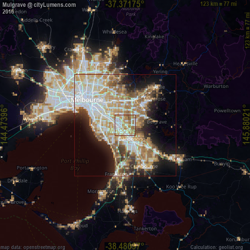
Analysis of Mulgrave night lights 2016
Square area 10x10 km:
 21.75%
90-99
22.89%80-89
8.6%70-79
18.02%60-69
20.94%50-59
7.31%40-49
0.49%30-39
0%20-29
0%10-19
0%0-9
0%Square area 50x50 km:
11.08%90-99
10.17%80-89
5.5%70-79
8.16%60-69
7.41%50-59
6.03%40-49
4%30-39
3.59%20-29
5.32%10-19
9.17%0-9
29.57%Clear (daylight) street map image can be seen on geolist.org.
Map coordinates:
37° 22' 18.3" South, 144° 28' 26.3" East
37° 55' 42.4" South, 145° 10' 37.5" East
38° 28' 51.5" South, 145° 52' 48.8" East
Some cities around Mulgrave sort by population:
• Rowville
5 km =3.1 mi,  96°
96°
• Noble Park
4.3 km =2.7 mi,  192°
192°
• Dandenong North
5 km =3.1 mi,  147°
147°
• Springvale
3.1 km =1.9 mi,  223°
223°
• Wheelers Hill
3.2 km =2 mi,  9°
9°
• Springvale South
4.9 km =3 mi,  209°
209°
• Clayton South
5.3 km =3.3 mi,  264°
264°
• Noble Park North
2.7 km =1.7 mi, 150°
2156340 (p: 17,647)
Sources (retrieved 2019-11-25):
» Earth at Night: Flat Maps 2012, 2016