Rockingham night lights from space
Night Light of Rockingham (Western Australia) from space (Australia) Src. Average luminocity for 10x10km area is 47.6758% and for 50x50km: 19.4882%.
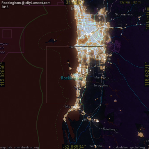
Analysis of Rockingham night lights 2016
Square area 10x10 km:
 10.26%
90-99
9.52%80-89
1.47%70-79
2.93%60-69
12.27%50-59
12.09%40-49
4.58%30-39
5.86%20-29
11.72%10-19
16.48%0-9
12.82%Square area 50x50 km:
2.86%90-99
3.1%80-89
2.03%70-79
2.47%60-69
5.07%50-59
3.86%40-49
2.64%30-39
2.48%20-29
4.17%10-19
8.05%0-9
63.26%Clear (daylight) street map image can be seen on geolist.org.
Map coordinates:
31° 40' 49.4" South, 115° 1' 36" East
32° 16' 36.6" South, 115° 43' 47.2" East
32° 52' 9.6" South, 116° 25' 58.5" East
Some cities around Rockingham sort by population:
• Kwinana
7.1 km =4.4 mi,  43°
43°
• Port Kennedy
10.9 km =6.8 mi,  169°
169°
• Waikiki
4.9 km =3 mi,  151°
151°
• Warnbro
7.2 km =4.5 mi, 166°
• Wellard
9.8 km =6.1 mi,  83°
83°
• Safety Bay
3.3 km =2.1 mi,  159°
159°
• Cooloongup
6.2 km =3.9 mi,  133°
133°
• Parmelia
8.9 km =5.5 mi, 76°
2062338 (p: 108,022)
Sources (retrieved 2019-11-25):
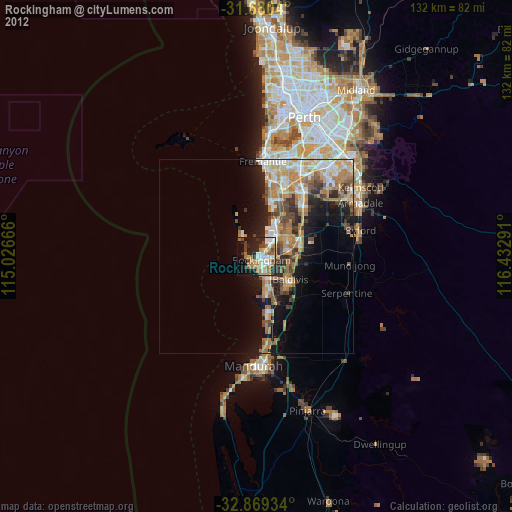
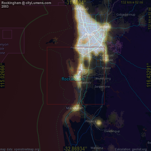
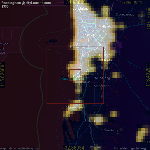
» NASA, Earths city lights 1995
» NASA city lights 2003
» Earth at Night: Flat Maps 2012, 2016