Officer night lights from space
Night Light of Officer (Victoria) from space (Australia) Src. Average luminocity for 10x10km area is 33.2532% and for 50x50km: 21.8431%.
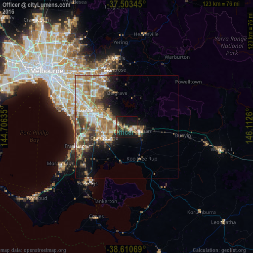
Analysis of Officer night lights 2016
Square area 10x10 km:
 2.6%
2.6%90-99
5.03%80-89
1.95%70-79
5.68%60-69
6.49%50-59
4.87%40-49
6.17%30-39
3.08%20-29
9.42%10-19
46.43%0-9
8.28%Square area 50x50 km:
3.6%90-99
3.9%80-89
1.94%70-79
4.14%60-69
4.85%50-59
3.9%40-49
2.8%30-39
2.78%20-29
3.06%10-19
7.6%0-9
61.43%Clear (daylight) street map image can be seen on geolist.org.
Map coordinates:
37° 30' 12.4" South, 144° 42' 22.9" East
38° 3' 33" South, 145° 24' 34.1" East
38° 36' 38.5" South, 146° 6' 45.4" East
Some cities around Officer sort by population:
• Berwick
5.9 km =3.7 mi,  298°
298°
• Pakenham
5.8 km =3.6 mi,  102°
102°
• Narre Warren South
10.4 km =6.5 mi,  279°
279°
• Narre Warren
10 km =6.2 mi,  286°
286°
• Cranbourne North
9.9 km =6.2 mi,  258°
258°
• Cranbourne East
11.6 km =7.2 mi,  237°
237°
• Clyde North
9.2 km =5.7 mi,  226°
226°
• Beaconsfield
3.9 km =2.4 mi, 285°
2154481 (p: 7,044)
Sources (retrieved 2019-11-25):
» Earth at Night: Flat Maps 2012, 2016