Neutral Bay night lights from space
Night Light of Neutral Bay (New South Wales) from space (Australia) Src. Average luminocity for 10x10km area is 79.2028% and for 50x50km: 40.2498%.
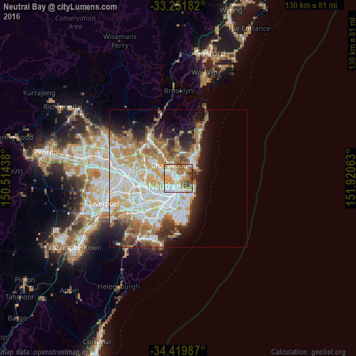
Analysis of Neutral Bay night lights 2016
Square area 10x10 km:
 22.38%
90-99
19.58%80-89
6.12%70-79
17.31%60-69
18.88%50-59
7.87%40-49
4.55%30-39
3.32%20-29
0%10-19
0%0-9
0%Square area 50x50 km:
9.46%90-99
10.15%80-89
4.96%70-79
6.55%60-69
7.79%50-59
3.53%40-49
2.37%30-39
3.53%20-29
4.73%10-19
7.44%0-9
39.49%Clear (daylight) street map image can be seen on geolist.org.
Map coordinates:
33° 15' 6.6" South, 150° 30' 51.8" East
33° 50' 16.2" South, 151° 13' 3" East
34° 25' 11.5" South, 151° 55' 14.3" East
Some cities around Neutral Bay sort by population:
• Mosman
2 km =1.2 mi,  93°
93°
• Cremorne
1.5 km =0.9 mi,  33°
33°
• Wollstonecraft
2.6 km =1.6 mi,  282°
282°
• North Sydney
1 km =0.6 mi,  262°
262°
• Cammeray
1.8 km =1.1 mi,  355°
355°
• St Leonards
2.4 km =1.5 mi,  312°
312°
• Northbridge
2.7 km =1.7 mi, 359°
• Naremburn
2.8 km =1.7 mi,  326°
326°
2207880 (p: 10,250)
Sources (retrieved 2019-11-25):
» Earth at Night: Flat Maps 2012, 2016