St Leonards night lights from space
Night Light of St Leonards (New South Wales) from space (Australia) Src. Average luminocity for 10x10km area is 79.215% and for 50x50km: 41.7929%.
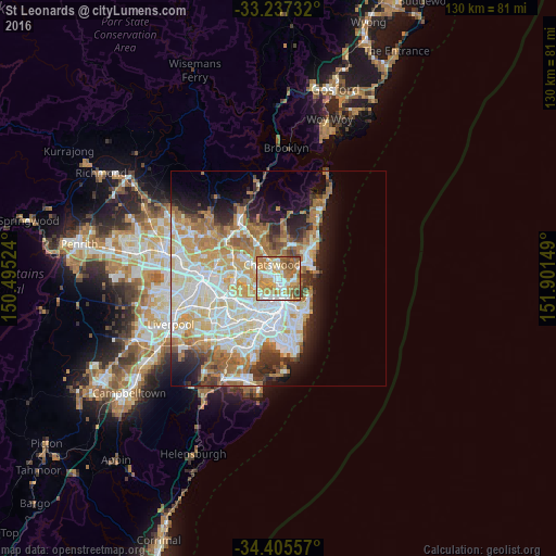
Analysis of St Leonards night lights 2016
Square area 10x10 km:
 15.73%
90-99
20.1%80-89
8.92%70-79
22.38%60-69
22.73%50-59
6.12%40-49
4.02%30-39
0%20-29
0%10-19
0%0-9
0%Square area 50x50 km:
9.99%90-99
10.75%80-89
5.39%70-79
6.62%60-69
7.87%50-59
3.5%40-49
2.36%30-39
3.4%20-29
4.71%10-19
7.53%0-9
37.88%Clear (daylight) street map image can be seen on geolist.org.
Map coordinates:
33° 14' 14.4" South, 150° 29' 42.9" East
33° 49' 24.4" South, 151° 11' 54.1" East
34° 24' 20.1" South, 151° 54' 5.4" East
Some cities around St Leonards sort by population:
• Artarmon
1.6 km =1 mi,  298°
298°
• Wollstonecraft
1.3 km =0.8 mi,  217°
217°
• North Sydney
1.9 km =1.2 mi,  154°
154°
• Cammeray
1.7 km =1.1 mi,  81°
81°
• Willoughby
2.1 km =1.3 mi,  2°
2°
• Northbridge
2.1 km =1.3 mi,  56°
56°
• Greenwich
2.3 km =1.4 mi, 218°
• Naremburn
0.8 km =0.5 mi,  17°
17°
8029783 (p: 6,343)
Sources (retrieved 2019-11-25):
» Earth at Night: Flat Maps 2012, 2016