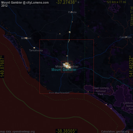
Mount Gambier night lights from space
Night Light of Mount Gambier (South Australia) from space (Australia) Src. Average luminocity for 10x10km area is 20.7806% and for 50x50km: 0.975%.
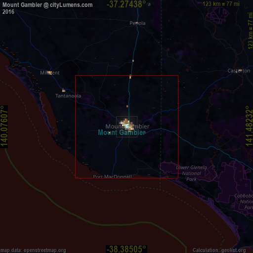
Analysis of Mount Gambier night lights 2016
Square area 10x10 km:
 1.87%
1.87%90-99
1.7%80-89
1.87%70-79
3.23%60-69
4.25%50-59
4.93%40-49
3.91%30-39
4.42%20-29
1.02%10-19
9.01%0-9
63.78%Square area 50x50 km:
0.07%90-99
0.07%80-89
0.07%70-79
0.16%60-69
0.2%50-59
0.24%40-49
0.16%30-39
0.18%20-29
0.05%10-19
0.42%0-9
98.38%Clear (daylight) street map image can be seen on geolist.org.
Map coordinates:
37° 16' 27.8" South, 140° 4' 33.9" East
37° 49' 54.5" South, 140° 46' 45.1" East
38° 23' 6.2" South, 141° 28' 56.4" East
Some cities around Mount Gambier sort by population:
• Warrnambool
161.5 km =100.4 mi,  112°
112°
• Horsham
177 km =110 mi,  45°
45°
• Hamilton
109.6 km =68.1 mi,  84°
84°
• Portland
92 km =57.2 mi,  128°
128°
• Colac
251.9 km =156.5 mi,  102°
102°
• Ararat
198.8 km =123.5 mi,  72°
72°
• Stawell
196.6 km =122.2 mi,  63°
63°
• Naracoorte
97.2 km =60.4 mi,  357°
357°
2156643 (p: 25,030)
Sources (retrieved 2019-11-25):
» Earth at Night: Flat Maps 2012, 2016