Leeming night lights from space
Night Light of Leeming (Western Australia) from space (Australia) Src. Average luminocity for 10x10km area is 83.2185% and for 50x50km: 40.1227%.
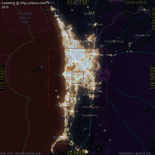
Analysis of Leeming night lights 2016
Square area 10x10 km:
 19.06%
90-99
21.85%80-89
16.61%70-79
26.05%60-69
7.87%50-59
5.94%40-49
2.62%30-39
0%20-29
0%10-19
0%0-9
0%Square area 50x50 km:
9.14%90-99
9.64%80-89
4.32%70-79
5.48%60-69
8.12%50-59
5.1%40-49
3.52%30-39
3.25%20-29
5.74%10-19
8.31%0-9
37.39%Clear (daylight) street map image can be seen on geolist.org.
Map coordinates:
31° 28' 38.6" South, 115° 9' 46.8" East
32° 4' 30.4" South, 115° 51' 58.1" East
32° 40' 8.3" South, 116° 34' 9.3" East
Some cities around Leeming sort by population:
• Willetton
3.2 km =2 mi,  39°
39°
• Kardinya
4.9 km =3 mi,  282°
282°
• Bull Creek
2.1 km =1.3 mi,  350°
350°
• Mount Pleasant
4.2 km =2.6 mi,  338°
338°
• Winthrop
4.3 km =2.7 mi,  306°
306°
• South Lake
4.8 km =3 mi,  212°
212°
• Bibra Lake
5.1 km =3.2 mi,  240°
240°
• Booragoon
5 km =3.1 mi,  322°
322°
8348304 (p: 10,476)
Sources (retrieved 2019-11-25):
» Earth at Night: Flat Maps 2012, 2016