Willetton night lights from space
Night Light of Willetton (Western Australia) from space (Australia) Src. Average luminocity for 10x10km area is 87.4773% and for 50x50km: 41.1264%.
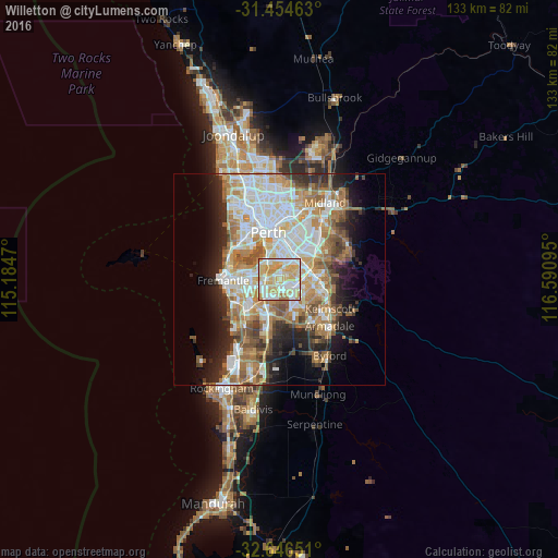
Analysis of Willetton night lights 2016
Square area 10x10 km:
 21.33%
90-99
26.4%80-89
21.85%70-79
27.1%60-69
2.8%50-59
0.52%40-49
0%30-39
0%20-29
0%10-19
0%0-9
0%Square area 50x50 km:
9.24%90-99
9.89%80-89
4.58%70-79
5.92%60-69
8.11%50-59
4.87%40-49
3.52%30-39
3.44%20-29
6.4%10-19
8.43%0-9
35.59%Clear (daylight) street map image can be seen on geolist.org.
Map coordinates:
31° 27' 16.7" South, 115° 11' 4.9" East
32° 3' 9" South, 115° 53' 16.2" East
32° 38' 47.4" South, 116° 35' 27.4" East
Some cities around Willetton sort by population:
• Canning Vale
2.9 km =1.8 mi,  102°
102°
• Leeming
3.2 km =2 mi,  219°
219°
• Bull Creek
2.4 km =1.5 mi,  260°
260°
• Mount Pleasant
3.8 km =2.4 mi,  291°
291°
• Wilson
4.2 km =2.6 mi,  32°
32°
• Parkwood
2.9 km =1.8 mi,  82°
82°
• Langford
5.2 km =3.2 mi, 75°
• Riverton
2.2 km =1.4 mi, 27°
8348101 (p: 17,887)
Sources (retrieved 2019-11-25):
» Earth at Night: Flat Maps 2012, 2016