Winthrop night lights from space
Night Light of Winthrop (Western Australia) from space (Australia) Src. Average luminocity for 10x10km area is 84.3794% and for 50x50km: 40.9911%.
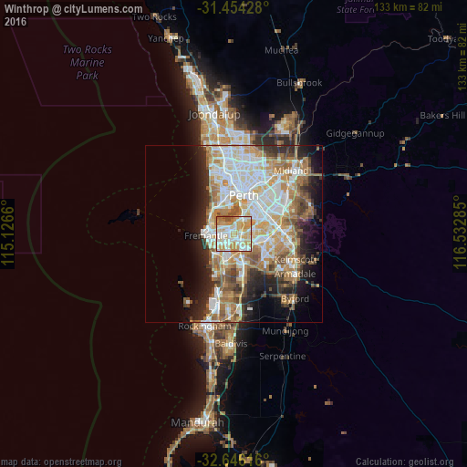
Analysis of Winthrop night lights 2016
Square area 10x10 km:
 18.88%
90-99
25.7%80-89
16.43%70-79
26.4%60-69
6.99%50-59
2.45%40-49
3.15%30-39
0%20-29
0%10-19
0%0-9
0%Square area 50x50 km:
9.24%90-99
9.89%80-89
4.58%70-79
5.92%60-69
8.11%50-59
4.84%40-49
3.49%30-39
3.44%20-29
6.32%10-19
8.41%0-9
35.76%Clear (daylight) street map image can be seen on geolist.org.
Map coordinates:
31° 27' 15.4" South, 115° 7' 35.8" East
32° 3' 7.8" South, 115° 49' 47" East
32° 38' 46.2" South, 116° 31' 58.3" East
Some cities around Winthrop sort by population:
• Kardinya
2.1 km =1.3 mi,  223°
223°
• Bull Creek
3.1 km =1.9 mi,  98°
98°
• Applecross
4 km =2.5 mi,  4°
4°
• Mount Pleasant
2.4 km =1.5 mi,  54°
54°
• Attadale
4 km =2.5 mi,  319°
319°
• Melville
3 km =1.9 mi,  295°
295°
• Booragoon
1.5 km =0.9 mi,  14°
14°
• Coolbellup
3.9 km =2.4 mi,  214°
214°
8349115 (p: 5,804)
Sources (retrieved 2019-11-25):
» Earth at Night: Flat Maps 2012, 2016