Mount Pleasant night lights from space
Night Light of Mount Pleasant (Western Australia) from space (Australia) Src. Average luminocity for 10x10km area is 83.8339% and for 50x50km: 41.478%.
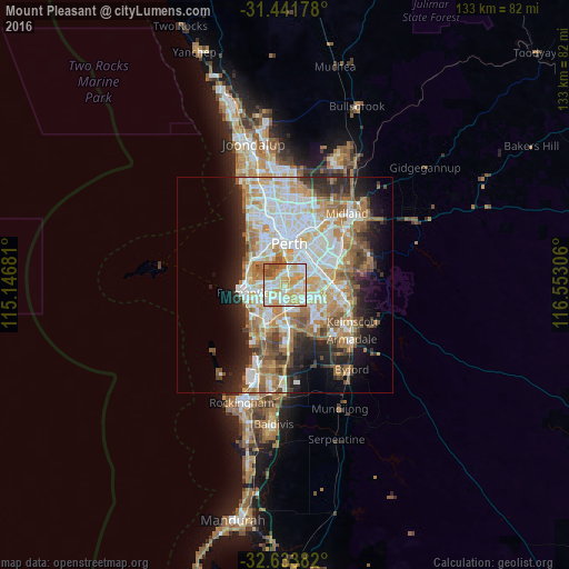
Analysis of Mount Pleasant night lights 2016
Square area 10x10 km:
 17.13%
90-99
26.57%80-89
18.53%70-79
23.43%60-69
6.82%50-59
2.62%40-49
4.9%30-39
0%20-29
0%10-19
0%0-9
0%Square area 50x50 km:
9.3%90-99
9.98%80-89
4.72%70-79
6.04%60-69
8.05%50-59
4.81%40-49
3.52%30-39
3.52%20-29
6.69%10-19
8.48%0-9
34.89%Clear (daylight) street map image can be seen on geolist.org.
Map coordinates:
31° 26' 30.4" South, 115° 8' 48.5" East
32° 2' 23.1" South, 115° 50' 59.7" East
32° 38' 1.8" South, 116° 33' 11" East
Some cities around Mount Pleasant sort by population:
• Willetton
3.8 km =2.4 mi,  111°
111°
• Leeming
4.2 km =2.6 mi,  158°
158°
• Kardinya
4.4 km =2.7 mi,  228°
228°
• Bull Creek
2.2 km =1.4 mi,  147°
147°
• Applecross
3 km =1.9 mi,  328°
328°
• Winthrop
2.4 km =1.5 mi, 234°
• Riverton
4.6 km =2.9 mi,  83°
83°
• Booragoon
1.5 km =0.9 mi,  271°
271°
10056968 (p: 6,542)
Sources (retrieved 2019-11-25):
» Earth at Night: Flat Maps 2012, 2016