Kew East night lights from space
Night Light of Kew East (Victoria) from space (Australia) Src. Average luminocity for 10x10km area is 89.335% and for 50x50km: 54.3991%.
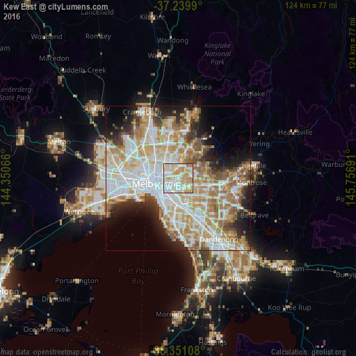
Analysis of Kew East night lights 2016
Square area 10x10 km:
 26.87%
90-99
29.25%80-89
19.22%70-79
18.88%60-69
5.78%50-59
0%40-49
0%30-39
0%20-29
0%10-19
0%0-9
0%Square area 50x50 km:
14.57%90-99
13.45%80-89
6.73%70-79
9.58%60-69
8.08%50-59
5.46%40-49
3.91%30-39
3.36%20-29
5.99%10-19
7.49%0-9
21.38%Clear (daylight) street map image can be seen on geolist.org.
Map coordinates:
37° 14' 23.6" South, 144° 21' 2.4" East
37° 47' 51.3" South, 145° 3' 13.6" East
38° 21' 3.9" South, 145° 45' 24.9" East
Some cities around Kew East sort by population:
• Kew
2.2 km =1.4 mi,  244°
244°
• Hawthorn
2.9 km =1.8 mi,  212°
212°
• Glenferrie
4 km =2.5 mi,  184°
184°
• Balwyn North
3.6 km =2.2 mi,  78°
78°
• Hawthorn East
3.1 km =1.9 mi,  192°
192°
• Balwyn
2.6 km =1.6 mi,  120°
120°
• Ivanhoe
3.3 km =2.1 mi,  343°
343°
• Fairfield
3.7 km =2.3 mi,  301°
301°
7932628 (p: 6,496)
Sources (retrieved 2019-11-25):
» Earth at Night: Flat Maps 2012, 2016