Balwyn night lights from space
Night Light of Balwyn (Victoria) from space (Australia) Src. Average luminocity for 10x10km area is 86.7381% and for 50x50km: 53.4083%.
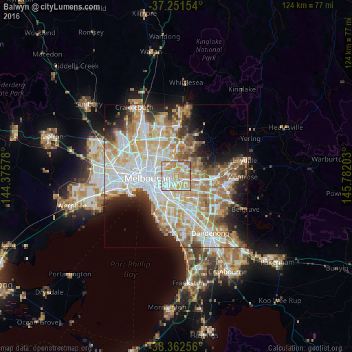
Analysis of Balwyn night lights 2016
Square area 10x10 km:
 19.56%
90-99
28.74%80-89
20.41%70-79
22.79%60-69
6.63%50-59
1.87%40-49
0%30-39
0%20-29
0%10-19
0%0-9
0%Square area 50x50 km:
13.99%90-99
13.13%80-89
6.54%70-79
9.46%60-69
8.05%50-59
5.48%40-49
4.01%30-39
3.59%20-29
6.09%10-19
7.48%0-9
22.18%Clear (daylight) street map image can be seen on geolist.org.
Map coordinates:
37° 15' 5.5" South, 144° 22' 32.8" East
37° 48' 32.9" South, 145° 4' 44" East
38° 21' 45.2" South, 145° 46' 55.3" East
Some cities around Balwyn sort by population:
• Hawthorn
4 km =2.5 mi,  252°
252°
• Camberwell
3.8 km =2.4 mi,  192°
192°
• Glenferrie
3.7 km =2.3 mi,  223°
223°
• Hawthorn East
3.3 km =2.1 mi,  238°
238°
• Surrey Hills
2 km =1.2 mi,  114°
114°
• Canterbury
1.8 km =1.1 mi,  163°
163°
• Kew East
2.6 km =1.6 mi,  300°
300°
• Mont Albert North
2.8 km =1.7 mi,  69°
69°
2177026 (p: 12,944)
Sources (retrieved 2019-11-25):
» Earth at Night: Flat Maps 2012, 2016