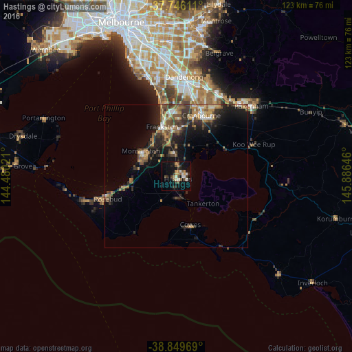
Hastings night lights from space
Night Light of Hastings (Victoria) from space (Australia) Src. Average luminocity for 10x10km area is 22.2942% and for 50x50km: 9.2243%.
Analysis of Hastings night lights 2016
Square area 10x10 km:
 2.55%
2.55%90-99
3.23%80-89
0.51%70-79
3.91%60-69
2.89%50-59
3.91%40-49
3.74%30-39
3.06%20-29
4.25%10-19
24.83%0-9
47.11%Square area 50x50 km:
0.83%90-99
0.87%80-89
0.58%70-79
1.56%60-69
1.54%50-59
1.71%40-49
1.85%30-39
2%20-29
3.09%10-19
7.12%0-9
78.84%Clear (daylight) street map image can be seen on geolist.org.
Map coordinates:
37° 44' 46" South, 144° 28' 48.8" East
38° 18' 0" South, 145° 10' 60" East
38° 50' 58.9" South, 145° 53' 11.3" East
Some cities around Hastings sort by population:
• Frankston
18.1 km =11.2 mi,  343°
343°
• Frankston East
19 km =11.8 mi,  346°
346°
• Mornington
15.6 km =9.7 mi,  305°
305°
• Langwarrin
14.9 km =9.3 mi, 354°
• Frankston South
15.4 km =9.6 mi, 344°
• Mount Martha
15 km =9.3 mi,  284°
284°
• Mount Eliza
15.6 km =9.7 mi,  326°
326°
• Somerville
9.4 km =5.8 mi, 351°
2163837 (p: 9,449)
Sources (retrieved 2019-11-25):
» Earth at Night: Flat Maps 2012, 2016