Frankston East night lights from space
Night Light of Frankston East (Victoria) from space (Australia) Src. Average luminocity for 10x10km area is 48.5833% and for 50x50km: 23.6117%.

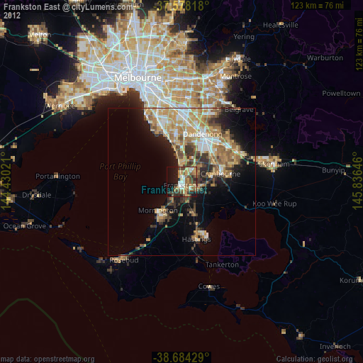
Analysis of Frankston East night lights 2016
Square area 10x10 km:
 8.5%
8.5%90-99
6.97%80-89
4.59%70-79
6.29%60-69
6.29%50-59
14.12%40-49
11.9%30-39
6.46%20-29
9.86%10-19
18.88%0-9
6.12%Square area 50x50 km:
3.6%90-99
4.27%80-89
2.13%70-79
4.65%60-69
4.23%50-59
3.94%40-49
3.05%30-39
2.98%20-29
4.77%10-19
9.89%0-9
56.49%Clear (daylight) street map image can be seen on geolist.org.
Map coordinates:
37° 34' 41.4" South, 144° 25' 48.8" East
38° 7' 60" South, 145° 7' 60" East
38° 41' 3.4" South, 145° 50' 11.3" East
Some cities around Frankston East sort by population:
• Langwarrin
4.7 km =2.9 mi,  141°
141°
• Carrum Downs
5.1 km =3.2 mi,  42°
42°
• Mount Eliza
7.1 km =4.4 mi,  218°
218°
• Seaford
3.7 km =2.3 mi,  0°
0°
• Skye
7.9 km =4.9 mi,  66°
66°
• Chelsea
9.4 km =5.8 mi,  351°
351°
• Patterson Lakes
7.2 km =4.5 mi,  6°
6°
• Bonbeach
7.6 km =4.7 mi, 353°
2166143 (p: 34,457)
Sources (retrieved 2019-11-25):
» Earth at Night: Flat Maps 2012, 2016