Mornington night lights from space
Night Light of Mornington (Victoria) from space (Australia) Src. Average luminocity for 10x10km area is 21.9592% and for 50x50km: 14.5672%.
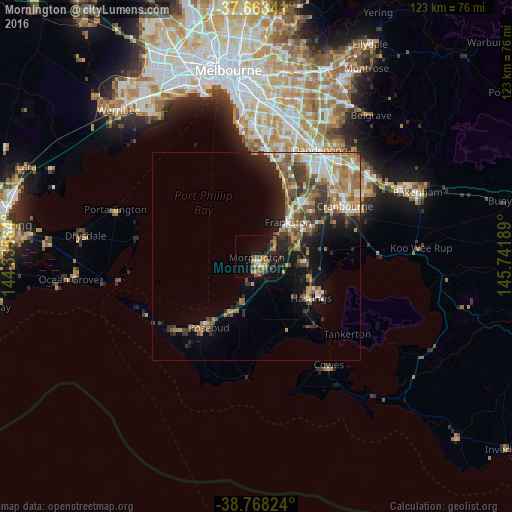
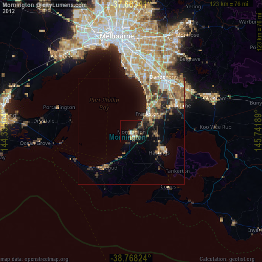
Analysis of Mornington night lights 2016
Square area 10x10 km:
 1.19%
1.19%90-99
0.85%80-89
1.36%70-79
4.93%60-69
4.76%50-59
4.25%40-49
5.95%30-39
2.21%20-29
7.14%10-19
21.94%0-9
45.41%Square area 50x50 km:
1.94%90-99
2.11%80-89
1.08%70-79
2.34%60-69
2.7%50-59
3%40-49
2.5%30-39
2.7%20-29
3.25%10-19
6.68%0-9
71.7%Clear (daylight) street map image can be seen on geolist.org.
Map coordinates:
37° 39' 48.3" South, 144° 20' 8.3" East
38° 13' 4.5" South, 145° 2' 19.5" East
38° 46' 5.7" South, 145° 44' 30.8" East
Some cities around Mornington sort by population:
• Frankston
11 km =6.8 mi,  42°
42°
• Frankston East
12.5 km =7.8 mi, 41°
• Langwarrin
12.5 km =7.8 mi,  62°
62°
• Frankston South
10.3 km =6.4 mi, 55°
• Mount Martha
5.8 km =3.6 mi,  199°
199°
• Mount Eliza
5.5 km =3.4 mi,  45°
45°
• Somerville
11.2 km =7 mi,  89°
89°
• Frankston North
14.2 km =8.8 mi, 42°
2156878 (p: 23,245)
Sources (retrieved 2019-11-25):
» Earth at Night: Flat Maps 2012, 2016