Mount Eliza night lights from space
Night Light of Mount Eliza (Victoria) from space (Australia) Src. Average luminocity for 10x10km area is 26.2024% and for 50x50km: 18.7094%.
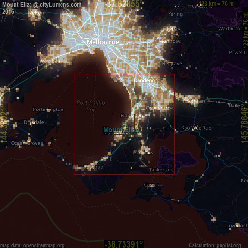
Analysis of Mount Eliza night lights 2016
Square area 10x10 km:
 1.87%
1.87%90-99
2.55%80-89
0.68%70-79
3.57%60-69
5.44%50-59
3.91%40-49
4.42%30-39
7.65%20-29
13.1%10-19
29.25%0-9
27.55%Square area 50x50 km:
2.49%90-99
3.05%80-89
1.45%70-79
3.47%60-69
3.6%50-59
3.61%40-49
2.8%30-39
2.97%20-29
4.09%10-19
7.9%0-9
64.57%Clear (daylight) street map image can be seen on geolist.org.
Map coordinates:
37° 37' 42.8" South, 144° 22' 48.8" East
38° 10' 60" South, 145° 4' 60" East
38° 44' 2.1" South, 145° 47' 11.3" East
Some cities around Mount Eliza sort by population:
• Frankston
5.5 km =3.4 mi,  38°
38°
• Frankston East
7.1 km =4.4 mi, 38°
• Mornington
5.5 km =3.4 mi,  225°
225°
• Langwarrin
7.5 km =4.7 mi,  75°
75°
• Frankston South
5 km =3.1 mi,  67°
67°
• Seaford
10.2 km =6.3 mi,  25°
25°
• Somerville
8.2 km =5.1 mi,  116°
116°
• Frankston North
8.7 km =5.4 mi, 40°
2156663 (p: 17,358)
Sources (retrieved 2019-11-25):
» Earth at Night: Flat Maps 2012, 2016