Langwarrin night lights from space
Night Light of Langwarrin (Victoria) from space (Australia) Src. Average luminocity for 10x10km area is 43.1395% and for 50x50km: 20.921%.
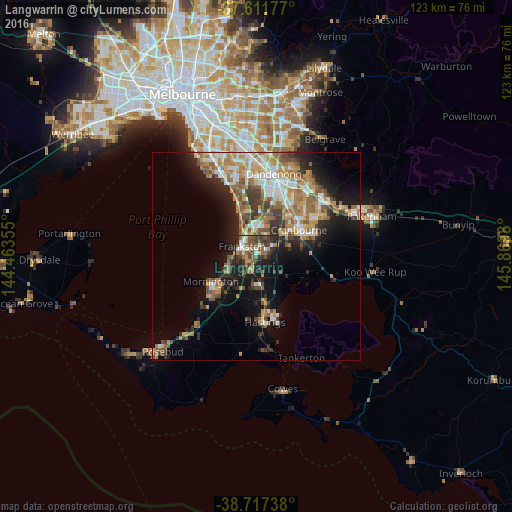
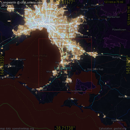
Analysis of Langwarrin night lights 2016
Square area 10x10 km:
 4.25%
4.25%90-99
5.1%80-89
3.23%70-79
5.95%60-69
6.12%50-59
10.88%40-49
11.73%30-39
13.44%20-29
17.18%10-19
18.88%0-9
3.23%Square area 50x50 km:
2.87%90-99
3.52%80-89
1.7%70-79
3.93%60-69
3.9%50-59
3.75%40-49
3.06%30-39
3.01%20-29
4.47%10-19
10.04%0-9
59.73%Clear (daylight) street map image can be seen on geolist.org.
Map coordinates:
37° 36' 42.4" South, 144° 27' 48.8" East
38° 10' 0" South, 145° 10' 0" East
38° 43' 2.6" South, 145° 52' 11.3" East
Some cities around Langwarrin sort by population:
• Frankston
4.5 km =2.8 mi,  302°
302°
• Frankston East
4.7 km =2.9 mi,  321°
321°
• Carrum Downs
7.5 km =4.7 mi,  3°
3°
• Frankston South
2.6 km =1.6 mi,  271°
271°
• Mount Eliza
7.5 km =4.7 mi,  255°
255°
• Seaford
8 km =5 mi,  338°
338°
• Somerville
5.6 km =3.5 mi,  180°
180°
• Frankston North
5.1 km =3.2 mi, 341°
2160582 (p: 22,146)
Sources (retrieved 2019-11-25):
» Earth at Night: Flat Maps 2012, 2016