Forest Lake night lights from space
Night Light of Forest Lake (Queensland) from space (Australia) Src. Average luminocity for 10x10km area is 68.8651% and for 50x50km: 38.9744%.
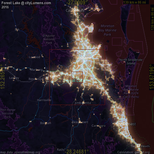
Analysis of Forest Lake night lights 2016
Square area 10x10 km:
 15.67%
90-99
12.1%80-89
7.94%70-79
11.9%60-69
16.67%50-59
15.08%40-49
4.56%30-39
7.34%20-29
8.73%10-19
0%0-9
0%Square area 50x50 km:
7.63%90-99
8.26%80-89
4.65%70-79
5.32%60-69
10.53%50-59
3.43%40-49
4.28%30-39
3.88%20-29
6.77%10-19
8.98%0-9
36.26%Clear (daylight) street map image can be seen on geolist.org.
Map coordinates:
27° 0' 3.2" South, 152° 15' 56.6" East
27° 37' 32.3" South, 152° 58' 7.8" East
28° 14' 48.5" South, 153° 40' 19.1" East
Some cities around Forest Lake sort by population:
• Springfield Lakes
6.4 km =4 mi,  222°
222°
• Inala
3.2 km =2 mi,  9°
9°
• Parkinson
6.3 km =3.9 mi,  108°
108°
• Goodna
7.1 km =4.4 mi,  283°
283°
• Algester
6.4 km =4 mi,  77°
77°
• Durack
4.4 km =2.7 mi,  22°
22°
• Camira
4.8 km =3 mi,  258°
258°
• Springfield
6 km =3.7 mi,  238°
238°
9957340 (p: 22,581)
Sources (retrieved 2019-11-25):
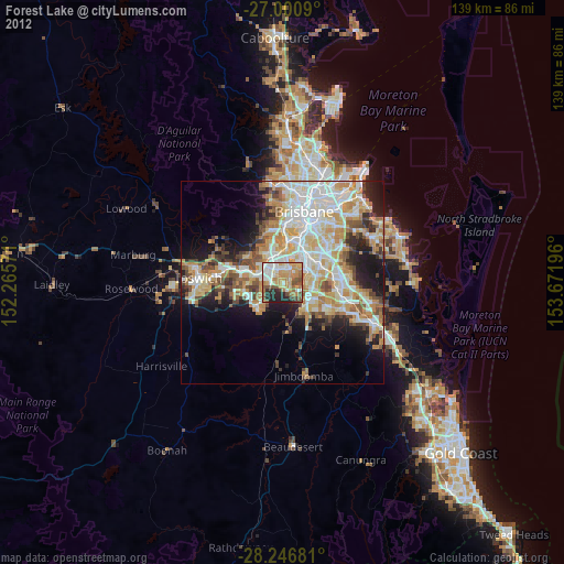
» Earth at Night: Flat Maps 2012, 2016