Algester night lights from space
Night Light of Algester (Queensland) from space (Australia) Src. Average luminocity for 10x10km area is 80.6349% and for 50x50km: 41.9221%.
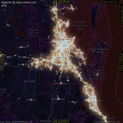
Analysis of Algester night lights 2016
Square area 10x10 km:
 15.67%
90-99
20.63%80-89
15.28%70-79
22.22%60-69
13.1%50-59
12.7%40-49
0.4%30-39
0%20-29
0%10-19
0%0-9
0%Square area 50x50 km:
7.92%90-99
8.66%80-89
4.96%70-79
5.57%60-69
11.61%50-59
3.72%40-49
4.47%30-39
4.72%20-29
7.48%10-19
11.67%0-9
29.23%Clear (daylight) street map image can be seen on geolist.org.
Map coordinates:
26° 59' 16.8" South, 152° 19' 45.4" East
27° 36' 46" South, 153° 1' 56.6" East
28° 14' 2.6" South, 153° 44' 7.9" East
Some cities around Algester sort by population:
• Sunnybank Hills
2.1 km =1.3 mi,  82°
82°
• Calamvale
1.9 km =1.2 mi,  127°
127°
• Runcorn
4.7 km =2.9 mi,  68°
68°
• Parkinson
3.4 km =2.1 mi,  184°
184°
• Sunnybank
4.6 km =2.9 mi,  37°
37°
• Durack
5.3 km =3.3 mi,  299°
299°
• Acacia Ridge
3.3 km =2.1 mi,  1°
1°
• Coopers Plains
5.4 km =3.4 mi,  8°
8°
8348977 (p: 8,330)
Sources (retrieved 2019-11-25):
» Earth at Night: Flat Maps 2012, 2016