Springfield night lights from space
Night Light of Springfield (Queensland) from space (Australia) Src. Average luminocity for 10x10km area is 53.9702% and for 50x50km: 32.8463%.
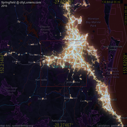
Analysis of Springfield night lights 2016
Square area 10x10 km:
 6.94%
6.94%90-99
8.33%80-89
4.56%70-79
4.17%60-69
23.21%50-59
9.52%40-49
7.94%30-39
9.33%20-29
13.1%10-19
12.9%0-9
0%Square area 50x50 km:
6.38%90-99
6.94%80-89
3.71%70-79
4.93%60-69
8.77%50-59
3.03%40-49
3.36%30-39
3.4%20-29
5.07%10-19
7.78%0-9
46.61%Clear (daylight) street map image can be seen on geolist.org.
Map coordinates:
27° 1' 44.7" South, 152° 12' 50.5" East
27° 39' 13.1" South, 152° 55' 1.8" East
28° 16' 28.8" South, 153° 37' 13" East
Some cities around Springfield sort by population:
• Forest Lake
6 km =3.7 mi,  58°
58°
• Redbank Plains
5.7 km =3.5 mi,  278°
278°
• Inala
8.4 km =5.2 mi,  41°
41°
• Goodna
5.1 km =3.2 mi,  339°
339°
• Greenbank
9.6 km =6 mi,  137°
137°
• Camira
2.1 km =1.3 mi,  9°
9°
• Collingwood Park
7.2 km =4.5 mi,  308°
308°
• Bellbird Park
3.5 km =2.2 mi,  302°
302°
9957703 (p: 6,705)
Sources (retrieved 2019-11-25):
» Earth at Night: Flat Maps 2012, 2016