Fairfield night lights from space
Night Light of Fairfield (New South Wales) from space (Australia) Src. Average luminocity for 10x10km area is 94.007% and for 50x50km: 58.1323%.
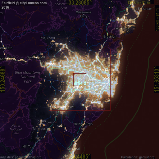
Analysis of Fairfield night lights 2016
Square area 10x10 km:
 35.49%
90-99
37.76%80-89
19.58%70-79
5.77%60-69
1.05%50-59
0.35%40-49
0%30-39
0%20-29
0%10-19
0%0-9
0%Square area 50x50 km:
13.22%90-99
14.17%80-89
7.79%70-79
9.39%60-69
10.73%50-59
5.8%40-49
4.07%30-39
5.85%20-29
7.55%10-19
10.31%0-9
11.11%Clear (daylight) street map image can be seen on geolist.org.
Map coordinates:
33° 16' 51.1" South, 150° 14' 48.8" East
33° 52' 0" South, 150° 57' 0" East
34° 26' 54.6" South, 151° 39' 11.3" East
Some cities around Fairfield sort by population:
• Merrylands
4.8 km =3 mi,  39°
39°
• Cabramatta
3.7 km =2.3 mi,  202°
202°
• Smithfield
2.4 km =1.5 mi,  320°
320°
• Canley Heights
3 km =1.9 mi,  233°
233°
• Canley Vale
2.2 km =1.4 mi,  184°
184°
• Cabramatta West
4.6 km =2.9 mi, 230°
• Merrylands West
4.2 km =2.6 mi,  24°
24°
• Villawood
3.4 km =2.1 mi,  125°
125°
2166952 (p: 17,932)
Sources (retrieved 2019-11-25):
» Earth at Night: Flat Maps 2012, 2016