Ellenbrook night lights from space
Night Light of Ellenbrook (Western Australia) from space (Australia) Src. Average luminocity for 10x10km area is 34.6099% and for 50x50km: 28.1605%.
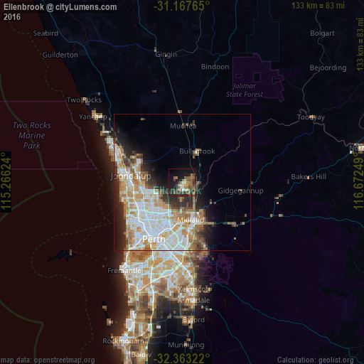
Analysis of Ellenbrook night lights 2016
Square area 10x10 km:
 1.65%
1.65%90-99
3.48%80-89
2.93%70-79
2.75%60-69
10.81%50-59
10.62%40-49
4.4%30-39
10.81%20-29
7.33%10-19
26.01%0-9
19.23%Square area 50x50 km:
6.8%90-99
7.03%80-89
2.67%70-79
3.65%60-69
5.15%50-59
2.95%40-49
1.97%30-39
3.06%20-29
4.96%10-19
6.59%0-9
55.16%Clear (daylight) street map image can be seen on geolist.org.
Map coordinates:
31° 10' 3.5" South, 115° 15' 58.5" East
31° 46' 2.5" South, 115° 58' 9.7" East
32° 21' 47.6" South, 116° 40' 21" East
Some cities around Ellenbrook sort by population:
• Ballajura
10.7 km =6.6 mi,  220°
220°
• Landsdale
10.7 km =6.6 mi,  245°
245°
• Aveley
2.5 km =1.6 mi,  129°
129°
• Beechboro
11.3 km =7 mi,  195°
195°
• Alexander Heights
11.9 km =7.4 mi,  235°
235°
• Darch
12.7 km =7.9 mi, 246°
• Bennett Springs
10.5 km =6.5 mi,  192°
192°
• Bullsbrook
11.3 km =7 mi,  14°
14°
8348596 (p: 22,209)
Sources (retrieved 2019-11-25):
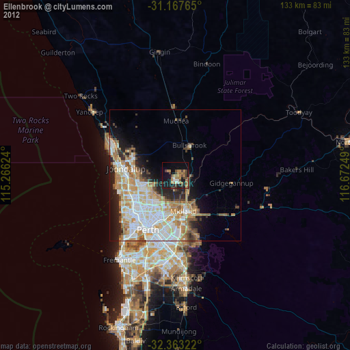
» Earth at Night: Flat Maps 2012, 2016